VCBS Covered Bridge Tour
Welcome to the Vermont Covered Bridge Society Covered Bridge Tour. This project is provided to share some basic information and facts about Vermont's covered bridges. Also included are Google Maps for each bridge. There are still over one hundred covered bridges in the state. Every county, with the exception of Grand Isle, has covered bridges waiting to be explored. This tour is our way of introducing you, the visitor, to one of Vermont's timeless treasures: the covered bridge.
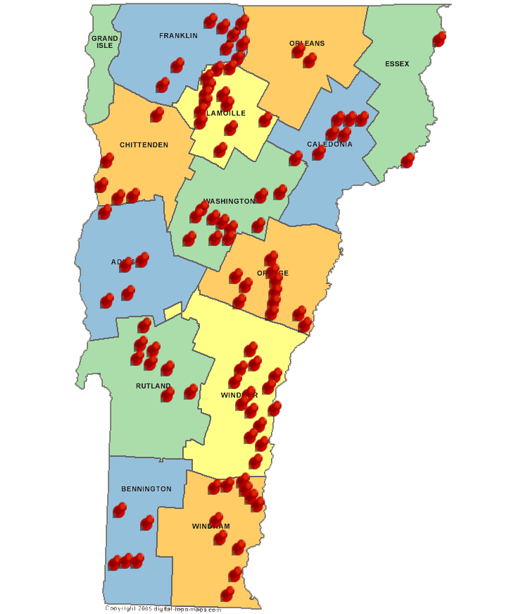
The Vermont state map below will give an interactive experience with the covered bridges in each of the counties. Select the county of interest and you will be on your way to learning about the bridge you may be standing in front of. Take your time and enjoy the tour.
We are pleased to feature bridge pictures by a number of different photographers. The contributors include Joseph C. Nelson, Scott Wagner, Steve Brown, William Caswell, Mel Huff, Phillip Jordan, Steve Bergeron, Gloria Smedley, Jennifer Bushey Parker, Barbara Nowik, and Ceegee's Photos. We appreciate their contributions as we work to keep the pictures up to date.
Credits: All pictures, information and descriptions are taken from Spanning Time Vermont's Covered Bridges by Joseph C. Nelson ©1997 and the World Guide to Covered Bridges - 2009 unless otherwise specified.