
The Keatings Ultimate Covered Bridge Tour

Part I
Hi Folks,
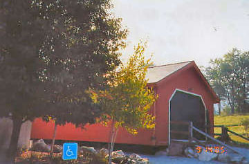
We arrived at the Bennington Best Western about 4pm on Sept 13. After checking in, we drove to the two Bennington area covered bridges that we missed on our previous trip 25 years ago, Chiselville and West Arlington. Both bridges are in excellent shape.
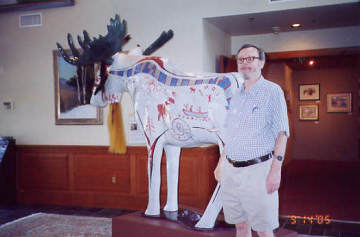
On September 14, we drove to the Vermont Covered Bridge Museum with a "Moosefest" Moose on the grounds and another inside the entrance. I took Liz's picture with the outside moose and she took mine with the inside moose. We enjoyed the museum. The rest of the pictures are by Liz.
We are using "Covered Bridges of Vermont" by Ed Barna for directions. For the most part, directions were very good, although after comparing it to Joe Nelson's book at the museum, I think Joe's book is better.
Buffalo, NY had buffalo statues around town several years ago. After being displayed for 6 months, they were auctioned off with proceeds going to various charities, including Children's Hospital, so important to our granddaughter Julia. One of the buffaloes is now at Children's Hospital permanently.
We then did some shopping at a nearby craft complex with a winery store. Then we drove to some Rutland area bridges--Brown, Kingsley, and the Rutland Twin.
The Rutland Twin, the extant half of the twin bridges, no longer is used as a bridge but a storage shed for Rutland's highway dept. Kingsley and Brown are in excellent shape.
Tom
![Chiselville Bridge [WGN 45-02-05]](ultimate_tour_2005/chiselville_keating_05100901.jpg)
Photo by Liz Keating
September 13, 2005

Photo by Liz Keating
September 13, 2005
![West Arlington Bridge [WGN 45-02-01]](ultimate_tour_2005/warlington_keating_05100901.jpg)
Photo by Liz Keating
September 13, 2005
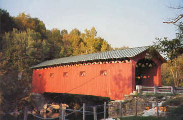
Photo by Liz Keating
September 13, 2005
at Bennington Center for the Arts
Photo by Liz Keating
September 14, 2005
at Bennington Center for the Arts
Photo by Liz Keating
September 14, 2005
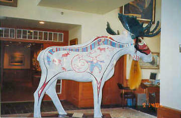
Photo by Liz Keating
September 14, 2005
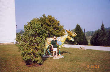
at Bennington Center for the Arts
Photo by Tom Keating
September 14, 2005
![Brown Bridge [WGN 45-11-09]](ultimate_tour_2005/brown_keating_05100901.jpg)
Photo by Liz Keating
September 14, 2005
![Kingsley Bridge [WGN 45-11-03]](ultimate_tour_2005/kingsley_keating_05100901.jpg)
Photo by Liz Keating
September 14, 2005
![Rutland Twin Bridge [WGN 45-11-10]](ultimate_tour_2005/rutlandtwin_keating_05100901.jpg)
Photo by Liz Keating
September 14, 2005
Part II
Hi Folks,
Continuing on September 14, we visited the Cooley, Sanderson and Depot bridges.
Cooley bridge is canted off to the side. The Depot Road is closed at the intersection with Rt 7. We parked at the convenience store and walked about .7 miles. The road is open to local traffic and there were a lot of vehicles going to the town dump. There is a steep hill going down to the dump. In the Depot picture I can be seen talking to a local woman who told us about the dump truck damaging the bridge. She gets her exercise by making six round trips from the railroad tracks to the bridge. She said that repair work should be completed in December.
We returned to our base in Bennington.
On 9-15 we headed north to the Lake Champlain Valley, visiting Shoreham RR, Cornwall-Salisbury, Pulp Mill, Spade Farm and Halpin bridges. The Shoreham pictures are from both sides. The dam and waterfall by the Pulp Mill bridge are quite scenic.
Pulp Mill Bridge is one of two two lane covered bridges in Vermont and one of seven in the U.S.-- built about 1808-1820. Pulp Mill bridge is generally agreed to be Vermont's oldest covered bridge. The pedestrian bridge was added in the last 10 years.
The Halpin bridge directions were complicated. We stopped and asked a policeman at a convenience store for directions. In general, tours in Ed Barna's book take us about 4-6 hrs.
Tom
![Cooley Bridge [WGN 45-11-07]](ultimate_tour_2005/cooley_keating_05101201.jpg)
Photo by Liz Keating
September 14, 2005
![Sanderson Bridge [WGN 45-11-02]](ultimate_tour_2005/sanderson_keating_05101201.jpg)
Photo by Liz Keating
September 14, 2005
![Depot Bridge [WGN 45-11-06]](ultimate_tour_2005/depot_keating_05101201.jpg)
Photo by Liz Keating
September 14, 2005
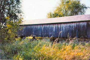
Photo by Liz Keating
September 14, 2005
![Halpin Bridge [WGN 45-01-03]](ultimate_tour_2005/halpin_keating_05101201.jpg)
Photo by Liz Keating
September 15, 2005
![Shoreham RR Bridge [WGN 45-01- 05]](ultimate_tour_2005/shoreham_keating_05101201.jpg)
Photo by Liz Keating
September 15, 2005
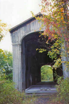
Photo by Liz Keating
September 15, 2005
![Salisbury Bridge [WGN 45-01- 01]](ultimate_tour_2005/salisbury_keating_05101201.jpg)
Photo by Liz Keating
September 15, 2005

Photo by Liz Keating
September 15, 2005
![Pulp Mill Bridge [WGN 45-01-04]](ultimate_tour_2005/pulpmill_keating_05101201.jpg)
Photo by Liz Keating
September 15, 2005
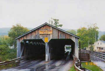
Photo by Liz Keating
September 15, 2005
![Spade Farm Bridge [WGN 45-01-02]](ultimate_tour_2005/spadefarm_keating_05101201.jpg)
Photo by Liz Keating
September 15, 2005
Part III
Hi Folks,
Continuing on September 15, we visited the following bridges, in Chittenden County: The Quinlan, Sequin, and Holmes. The Holmes Creek Bridge is next to Lake Champlain and is very scenic.
Instead of heading back directly south to Bennington, we drove east and south to Waitsfield in Washington County to visit Pine Brook, Village and Warren bridges. We didn't get back to our motel until 8pm, making for a long day.
On September 16, we left Bennington for Lincoln, NH. Along the way, we stopped to visit the Victorian Village bridge, right next to Rt. 103, in Windham County. It is next to the Vermont Country Store.
Tom
![Quinlan Bridge [WGN 45-04-03]](ultimate_tour_2005/quinlan_keating_05091501.jpg)
Photo by Liz Keating
September 15, 2005
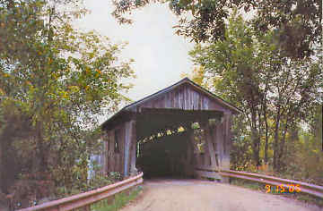
Photo by Liz Keating
September 15, 2005
![Seguin Bridge [WGN 45-04- 02]](ultimate_tour_2005/seguin_keating_05091501.jpg)
Photo by Liz Keating
September 15, 2005
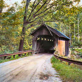
Photo by Liz Keating
September 15, 2005
![Holmes Creek Bridge [WGN 45-04- 01]](ultimate_tour_2005/holmes_keating_05091501.jpg)
Photo by Liz Keating
September 15, 2005
![Pine Brook Bridge [WGN 45-12- 12]](ultimate_tour_2005/pine-brook_keating_05091501.jpg)
Photo by Liz Keating
September 15, 2005
![Waitsfield Village Bridge [WGN 45-12-14]](ultimate_tour_2005/village_keating_05091501.jpg)
Photo by Liz Keating
September 15, 2005
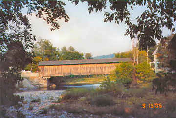
Photo by Liz Keating
September 15, 2005
![Warren Bridge [WGN 45-12-15]](ultimate_tour_2005/warren_keating_05091501.jpg)
Photo by Liz Keating
September 15, 2005
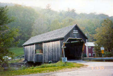
Photo by Liz Keating
September 15, 2005
![Victorian Bridge [45-13-03]](ultimate_tour_2005/victorian_keating_05091601.jpg)
Photo by Liz Keating
September 16, 2005
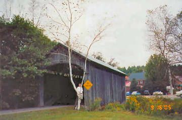
Photo by Liz Keating
September 16, 2005
Part IV
Hi Folks,
Continuing on September 16, we stopped at the Baltimore bridge next to the Eureka Schoolhouse, Vermont's oldest surviving one-room schoolhouse. The schoolhouse was open to visitors and had a few items for sale. Liz bought a Christmas ornament.
We then crossed the Connecticut river into New Hampshire and visited the Edgell bridge. We arrived in Lincoln at the Comfort Inn in the early afternoon. Since we had some free time, we drove north to see the Swiftwater, Bath/Haverhill, Bath, Mt. Orne, and Mechanic St. bridges.
Some of you might notice the date 1-1-98 on some of the pictures. Liz's camera battery died. She put in a new battery, but did not reset the date till we returned to the motel.
Liz and I climbed down to the riverbank to get a side view of Swiftwater bridge. I suspect that would not be possible now with the heavy rains in New Hampshire and Vermont these last few weeks. On the other hand, we missed the changing leaf colors.
The Mt. Orne bridge is one of three covered bridges that crosses the Connecticut river between Vermont and NH. Liz took two pictures one in each state.
The Mechanic St. bridge is closed for repairs--not even pedestrians can cross. I liked the open latticework on this bridge.
Mt. Orne and Mechanic St. are in the "Great North Woods" section of New Hampshire. Although we did not see any moose, there were many signs saying "Brake for Moose--It could save your life!" My brother, stationed in Alaska while in the army, once told me a story about a friend who lived off base. He drove a small sports car into work every day. One day he hit a moose. His car was a total loss. The moose walked away.
On September 17, we drove to the Hobo RR station, for a 2 1/2 hr train ride south thru the White Mountain National Forest to Plymouth and return. We each purchased a box lunch and had a choice of souvenirs--a "Hobo bundle stick" or a "Hobo drawstring sack." We each chose sacks (and gave them to our daughter for our two grandchildren when we returned home).
We stopped next to the Jack O'Lantern covered bridge (not authentic), in the Jack O'Lantern Golf Resort. Although passengers could get out, everybody could get a good picture.
We are using the "New Hampshire Covered Bridges Map and Guide" published by Hartnett House Map Publishers. We bought our copy from Amazon.com, but I saw it for sale at the craft complex across the road from the Covered Bridge Museum. According to the guide, the Jack O'Lantern Golf Resort was formerly called the Keating Country Club. I prefer Keating Country Club, myself. I think it has a nice sound--but I may be prejudiced.
I have also attached scans of me talking to the "Hobo," and standing in front of the Hobo RR engine. The "Hobo" did magic tricks and told jokes during the train ride.
Tom
![Baltimore Bridge [WGN 45-14- 03]](ultimate_tour_2005/baltimore_keating_05091801.jpg)
Photo by Liz Keating
September 16, 2005
![Edgell Bridge [WGN 29-05-11]](ultimate_tour_2005/edgell_keating_05091801.jpg)
Photo by Liz Keating
September 16, 2005
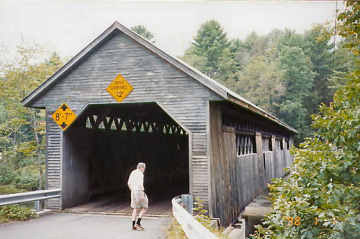
Photo by Liz Keating
September 16, 2005
![Bath-Haverhill Bridge [WGN 29-05- 04]](ultimate_tour_2005/bath-hav_keating_05091801.jpg)
Photo by Liz Keating
September 16, 2005
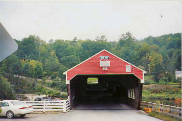
Photo by Liz Keating
September 16, 2005
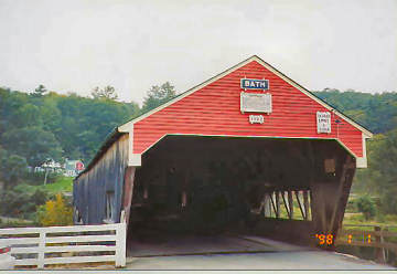
Photo by Liz Keating
September 16, 2005
![Mechanic Street Bridge [WGN 29-04-06]](ultimate_tour_2005/mechanic_keating_05091801.jpg)
Photo by Liz Keating
September 16, 2005
![Mt. Orne Bridge [WGN 29-04- 03]](ultimate_tour_2005/mt-orne_keating_05091801.jpg)
Photo by Liz Keating
September 16, 2005
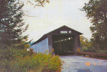
Photo by Liz Keating
September 16, 2005
![Swiftwater Bridge [WGN 29-05-02]](ultimate_tour_2005/swiftwater_keating_05091801.jpg)
Photo by Tom Keating
September 16, 2005
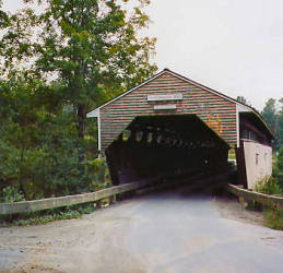
Photo by Liz Keating
September 16, 2005
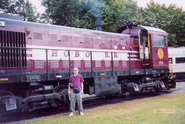
Photo by Liz Keating
September 16, 2005
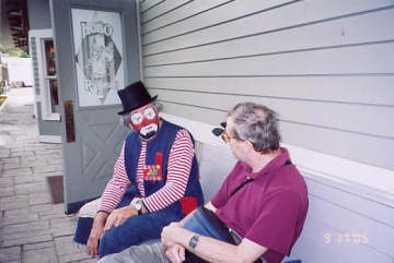
Photo by Liz Keating
September 16, 2005
![Jack O'Lantern Bridge [WGN 29-05-18]](ultimate_tour_2005/jackolantern_keating_05091801.jpg)
Photo by Liz Keating
September 16, 2005
Part V
Hi Folks,
After our train trip we headed out into the "Great North Woods" once more, on Rt. 3, the main road in northern Coos county.
Our first bridge, Stark is quite photogenic and has two pedestrian walkways. Groveton is open to pedestrians only, having been bypassed. I noticed that the open latticework style is much more common in NH vs. Vt. We continued north on Rt 3 to Columbia bridge, the second of the three covered bridges crossing the Connecticut river between Vt. and NH. Again Liz took one picture from each state.
As we continued north on Rt. 3 past Columbia to Pittsburg/Clarksville, River Road bridges, we see signs stating that the border crossing to Canada on Rt. 3 is closed from midnight to 8am, urging people to turn back and giving directions to Beecher Falls, Vt.
Pittsburg/Clarksville bridge actually crosses the Connecticut river inside NH and is the northernmost covered bridge over the river. It and River Road bridges are open to pedestrians only. Happy Corner is open to cars.
We also noticed signs stating NH law required everyone under 18 to wear a seatbelt. I later found out that all the other 49 states require everyone to wear seatbelts. "Live free or Die" is on all NH license plates.
On September 18, we rode the Winnipesaukee RR, run by the same company that owns the Hobo RR. After the train trip, we visited some more covered bridges--Squam River, Blair and Smith.
According to our guide, Milton Graton lived in Ashland all his life, but there was no covered bridge in the town. Local townspeople campaigned for the state to replace a deteriorating concrete/steel bridge with a covered bridge starting in the 1980s. The state only agreed when they were presented with a study showing the covered bridge was cheaper. Milton Graton was 81 when the bridge was completed and it was the last one that he built.
The Smith bridge has two signs--"Smith Millennium Bridge" and "2001." Our guide said that the previous bridge was completely destroyed by arson in 1993.
Tom
![Stark Bridge [WGN 29-04- 05]](ultimate_tour_2005/stark_keating_05091701.jpg)
Photo by Liz Keating
September 17, 2005
![Groveton Bridge [WGN 29-04-04]](ultimate_tour_2005/groveton_keating_05091701.jpg)
Photo by Liz Keating
September 17, 2005
![Columbia Bridge [WGN 45-05-07]](ultimate_tour_2005/columbia_keating_05091701.jpg)
Photo by Liz Keating
September 18, 2005
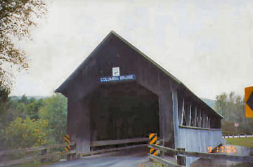
Photo by Liz Keating
September 18, 2005
![Pittsburg/Clarksville Bridge [29-04- 03]](ultimate_tour_2005/pittsburg_keating_05091701.jpg)
Photo by Liz Keating
September 18, 2005
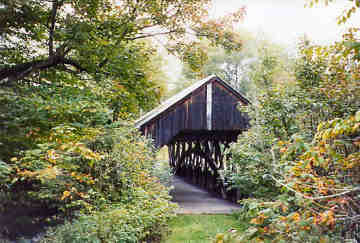
Photo by Liz Keating
September 18, 2005
![River Road Bridge [WGN 24-04- 02]](ultimate_tour_2005/riverrd_keating_05091701.jpg)
Photo by Liz Keating
September 17, 2005
![Happy Corner Bridge [WGN 29-04-01]](ultimate_tour_2005/happy_keating_05091701.jpg)
Photo by Liz Keating
September 18, 2005
![Squam River Bridge [WGN 29-05-112]](ultimate_tour_2005/squam_keating_05091801.jpg)
Photo by Liz Keating
September 18, 2005
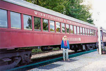
Photo by Liz Keating
September 18, 2005
Part VI
Hi Folks,
Continuing on September18, we visited Turkey Jim's and Bump bridges. Turkey Jim's is named after a local farmer Jim Cummings, who ran a turkey farm, where the first bridge at this site was built. Two of the three builders of the original Bump bridge were Sherm and Jim Bump.
At Lincoln, we turned east on Rt. 112, the Kancamagus Scenic highway, to visit Saco River and Bartlett bridges. Kancamagus highway is a very scenic road thru the White Mountain National Forest, but has curves and steep parts. We are careful to abide by speed limits, but were frequently passed by impatient folks. We came upon an accident that has just happened, with a minivan sideways across the road. Volunteer firemen directed us onto the opposing shoulder. As you can see by the scan, Bartlett bridge is now the "Covered Bridge Gift Shoppe." It was closed when we arrived.
On Sunday, the 19th, we left Lincoln, stopping in North Woodstock at The Christmas Loft for some shopping. We arrived in St. Johnsbury, Vt. too early to check in to our hotel, so we went to Lyndon, "Covered Bridge Capital of the Northeast Kingdom." There are five covered bridges in the town of Lyndon. The town is very proud of its bridges and has erected a stone/flower base sign next to the Sanborn bridge. The Sanborn is owned by a motel and has a room inside it. We got a map and pamphlet about the five bridges from the town library (also available at the Chamber of Commerce). Miller's Run has a pedestrian walkway. Schoolhouse and Randall have been bypassed and are for pedestrians only. Chamberlin's Mill was built in 1881. The mill is gone.
We then returned to St. Johnsbury, and checked in to the Comfort Inn, which billed itself as "The Taj Mahal of the Northeast Kingdom." It was a nice hotel, and we did have a nice room, but I think somebody went a bit too far with their slogan.
Tom
![Turkey Jim's Bridge [WGN 29-05-07]](ultimate_tour_2005/turkey-jims_keating_05091801.jpg)
Photo by Liz Keating
September 18, 2005
![Bump Bridge [WGN 29-05-08]](ultimate_tour_2005/bump_keating_05091801.jpg)
Photo by Liz Keating
September 18, 2005
![Bartlett Bridge [WGN 29-02- 02]](ultimate_tour_2005/bartlett_keating_05091801.jpg)
Photo by Liz Keating
September 18, 2005
![Saco River Bridge [WGN 29-02-03]](ultimate_tour_2005/saco-river_keating_05091801.jpg)
Photo by Liz Keating
September 18, 2005
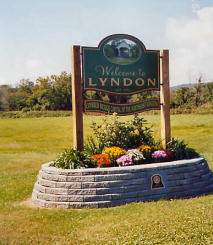
Photo by Liz Keating
September 19, 2005
![Chamberlin Bridge [WGN 45-03- 04]](ultimate_tour_2005/chamberlin_keating_05091901.jpg)
Photo by Liz Keating
September 19, 2005
![Schoolhouse Bridge [WGN 45-03- 03]](ultimate_tour_2005/schoolhouse_keating_05091901.jpg)
Photo by Liz Keating
September 19, 2005
![Randall Bridge [WGN 45-03-07]](ultimate_tour_2005/randall_keating_05091901.jpg)
Photo by Liz Keating
September 19, 2005
![Coburn Bridge [WGN 45-12-02]](ultimate_tour_2005/coburn_keating_05091901.jpg)
Photo by Liz Keating
September 19, 2005
![Robbins Nest Bridge [WGN 45-12- 18]](ultimate_tour_2005/robins-nest_keating_05091801.jpg)
Photo by Liz Keating
September 19, 2005
Part VII
Hi Folks,
After checking in at the St. Johnsbury Comfort Inn, we drove to two more bridges--Greenbanks Hollow and Martin. I liked Greenbanks Hollow's open white latticework. Martin is a private bridge.
According to a Northeast Kingdom tourist brochure, the Northeast Kingdom name comes from then Vermont State Senator George Aiken, who said in 1949, "This is such beautiful country up here-it should be called the Northeast Kingdom." It consists of three counties: Caledonia, Essex and Orleans.
On September 20 we visited Fisher RR, Red, Scribner, Hutchins, Fuller, Comstock, Longley, Creamery (Montgomery), Hopkins, River Rd.,and Orne bridges.
We started with Fisher RR bridge, located next to Rt. 15, the "Grand Army of The Republic Highway." The Grand Army of the Republic (GAR), was a social organization of Union army veterans from the US Civil War--similar to today's American Legion. There are two pictures of the Fisher RR bridge, one of which gives a better view of it's long cupola--which provided ventilation for smoke from coal fired railroad engines.
If you look carefully, you can see one of two steel beams inside the Hutchins bridge, evidently added for stabilization purposes. The beam was tied to the supports with steel cables. We noticed several bridges with these steel beams.
The Creamery bridge in Montgomery is closed to cars and the road leading to it is not maintained, so we parked and walked the last part of the road, as recommended by Ed Barna. If you look carefully, you can see the fire hydrant next to Hopkins.
At the River Rd. bridge, Liz took off her socks and shoes and waded out to a gravel bar to get her picture. She asked me if I was going to follow. I said "No thanks."
The Orne bridge, rebuilt after the previous one was destroyed by arson, has open latticework on one side.
Tom
![Greenbanks Hollow Bridge [WGN 45-03- 01]](ultimate_tour_2005/greenbanks_keating_05091901.jpg)
Photo by Liz Keating
September 19, 2005
![Martin Bridge [WGN 45-12-06]](ultimate_tour_2005/martin_keating_05091901.jpg)
Photo by Liz Keating
September 19, 2005
![Fisher RR Bridge [WGN 45-08-16]](ultimate_tour_2005/fisher_keating_05092001.jpg)
Photo by Liz Keating
September 20, 2005
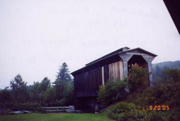
Photo by Liz Keating
September 20, 2005
![Red Bridge [WGN 45-08-12]](ultimate_tour_2005/red_keating_05092001.jpg)
Photo by Liz Keating
September 20, 2005
![Scribner Bridge [WGN 45-08-09]](ultimate_tour_2005/scribner_keating_05092001.jpg)
Photo by Liz Keating
September 20, 2005
![Hutchins Bridge [WGN 45-06-07]](ultimate_tour_2005/hutchins_keating_05092001.jpg)
Photo by Liz Keating
September 20, 2005
![Fuller Bridge [WGN 45-06- 05]](ultimate_tour_2005/fuller_keating_05092001.jpg)
Photo by Liz Keating
September 20, 2005
![Comstock Bridge [WGN 45-06- 04]](ultimate_tour_2005/comstock_keating_05092001.jpg)
Photo by Liz Keating
September 20, 2005
![Longley Bridge [WGN 45-06- 08]](ultimate_tour_2005/longley_keating_05092001.jpg)
Photo by Liz Keating
September 20, 2005
![Creamery Bridge [WGN 45-06-09]](ultimate_tour_2005/creamery_keating_05092001.jpg)
Photo by Liz Keating
September 20, 2005
![Hopkins Bridge [WGN 45-06-01]](ultimate_tour_2005/hopkins_keating_05092001.jpg)
Photo by Liz Keating
September 20, 2005
![River Road Bridge [WGN 45-10-03]](ultimate_tour_2005/river-road_keating_05092001.jpg)
Photo by Liz Keating
September 20, 2005
![Orne Bridge [WGN 45-10-01]](ultimate_tour_2005/orne_keating_05092001.jpg)
Photo by Liz Keating
September 20, 2005
Part VIII
Hi Folks,
On September 20, we saw one more bridge, the Lord's Creek Bridge, a private bridge in Irasburg. It is a rare Paddleford truss bridge. I liked its open latticework.
A noted Northeast Kingdom author, Howard Frank Mosher, lives in Irasburg. Upon returning from our trip, I went to the library and borrowed one of his books, "North Country: A Personal Journey." It is about his trip from Maine to Washington state along the US-Canada border. I enjoyed it and recommend it.
On September 21 we visited Maple St., Poland, Brown's River, Scott, Church, Mill/Lumbermill, Montgomery, Morgan, Union Village and Thetford Center bridges.
There are two pictures of the Poland, because Liz liked the 135-foot arch. The Brown's River Bridge has been bypassed and is well taken care of--note the flowers in the foreground. The second picture of the Morgan Bridge shows me looking downstream.
Thetford Center Bridge has a crack in a roof timber about halfway in.
Tom
![Lord's Creek Bridge [WGN 45-10-02]](ultimate_tour_2005/lords-creek_keating_05092001.jpg)
Photo by Liz Keating
September 20, 2005
![Maple Street Bridge [45-06-03]](ultimate_tour_2005/maple-st_keating_05092101.jpg)
Photo by Liz Keating
September 21, 2005
![Brown's River Bridge [WGN 45-04-05]](ultimate_tour_2005/browns-river_keating_05092101.jpg)
Photo by Liz Keating
September 21, 2005
![East Fairfield Bridge [WGN 45-06-03]](ultimate_tour_2005/e-fairfield_keating_05092101.jpg)
Photo by Liz Keating
September 20, 2005
![Poland Bridge [WGN 45-08-02]](ultimate_tour_2005/poland_keating_05092101.jpg)
Photo by Liz Keating
September 21, 2005
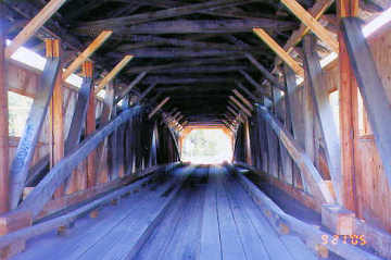
Photo by Liz Keating
September 21, 2005
![Church Street Bridge [WGN 45-08-13]](ultimate_tour_2005/church_keating_05092101.jpg)
Photo by Liz Keating
September 21, 2005
![Montgomery Bridge [45-08-14]](ultimate_tour_2005/montgomery_keating_05092101.jpg)
Photo by Liz Keating
September 21, 2005
![Morgan Bridge [WGN 45-08-07]](ultimate_tour_2005/morgan_keating_05092101.jpg)
Photo by Liz Keating
September 21, 2005
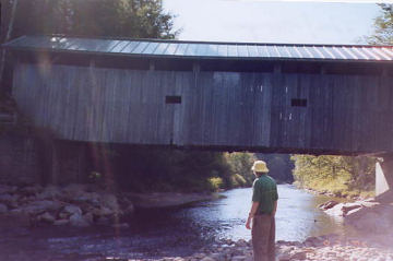
Photo by Liz Keating
September 21, 2005
![Mill Bridge [45-08-14]](ultimate_tour_2005/mill_keating_05092101.jpg)
Photo by Liz Keating
September 20, 2005
![Thetford Center Bridge [WGN 45-09- 06]](ultimate_tour_2005/thetford_keating_05092201.jpg)
Photo by Liz Keating
September 21, 2005
![Union Village Bridge [WGN 45-09-05]](ultimate_tour_2005/union_keating_05092201.jpg)
Photo by Liz Keating
September 21, 2005
![Scott Bridge [WGN 45-08-01]](ultimate_tour_2005/scott_keating_05092101.jpg)
Photo by Liz Keating
September 20, 2005
Part IX
Hi Folks,
On September 22, we visited the Thetford Center, Union Village, Moxely, Flint, Larkin, Mill Tunbridge, Howe, Cilley, Gifford, Braley, Kingsbury, Cornish-Windsor, Blacksmith Shop, and Dingleton Hill bridges. The last bridge is the Martinsville, which we visited in Vermont on the 23rd. The photos of the Thetford Center and the Union Village bridges were included in Ultimate Covered Bridge Tour 8.
The Flint, Larkin, Mill, Cilley and Howe are all in the town of Tunbridge, Vermont. There was a low budget movie a couple of years ago that took place in Tunbridge. It was about an affluent couple who moved to Tunbridge and hired a local handyman. There were some nice pictures of a couple of the covered bridges in the movie. Sorry, I don't remember the name of the movie.
I took the second picture of Gifford, with Liz. The Kingsbury, or Hyde, bridge was the subject of a lively discussion on this website recently. The consensus of opinion is that this is the bridge in "The Trouble with Harry", an Alfred Hitchcock movie.
The Cornish, New Hampshire-Windsor, Vermont bridge, at nearly 450 feet long, is the longest remaining wooden covered bridge in the USA and longest two-span covered bridge in the world. However, Ashtabula County, Ohio, is planning a 600 ft. covered bridge.
A 1934 US Supreme Court decision ruled that the Connecticut river was owned by New Hampshire up to the low water mark on the Vermont side of the river. This means that Vermont is only responsible for 6 feet of the Cornish-Windsor bridge (and all other bridges across the river between the two states). Cornish-Windsor, Blacksmith Shop, and Dingleton Hill bridges in New Hampshire were all built by James Tasker of Cornish, NH. The Blacksmith Shop Bridge is now open to pedestrians only
Tom
![Moxley Bridge [WGN 45-09-01]](ultimate_tour_2005/moxley_keating_05092201.jpg)
Photo by Liz Keating
September 22, 2005
![Flint Bridge [WGN 45-09-11]](ultimate_tour_2005/flint_keating_05092201.jpg)
Photo by Liz Keating
September 22, 2005
![Larkin Bridge [WGN 45-09- 10]](ultimate_tour_2005/larkin_keating_05092201.jpg)
Photo by Liz Keating
September 22, 2005
![Mill Bridge [WGN 45-09-09]](ultimate_tour_2005/mill_keating_05092201.jpg)
Photo by Liz Keating
September 22, 2005
![Howe Bridge [WGN 45-09-07]](ultimate_tour_2005/howe_keating_05092201.jpg)
Photo by Liz Keating
September 22, 2005
![Cilley Bridge [WGN 45-09-08]](ultimate_tour_2005/cilley_keating_05092201.jpg)
Photo by Liz Keating
September 22, 2005
![Gifford Bridge [WGN 45-09-03]](ultimate_tour_2005/gifford_keating_05092201.jpg)
Photo by Liz Keating
September 22, 2005
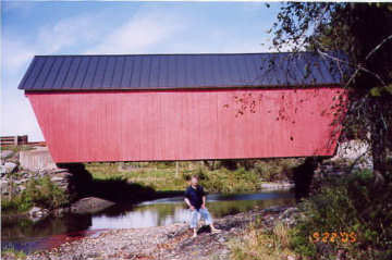
Photo by Tom Keating
September 22, 2005
![Braley Bridge [WGN 45-09-04]](ultimate_tour_2005/braley_keating_05092201.jpg)
Photo by Liz Keating
September 22, 2005
![Kingsbury Bridge [WGN 45-09-02]](ultimate_tour_2005/kingsbury_keating_05092201.jpg)
Photo by Liz Keating
September 22, 2005
![Cornish-Windsor Bridge [WGN 45-14-09]](ultimate_tour_2005/cornish_keating_05092201.jpg)
Photo by Liz Keating
September 22, 2005
![Blacksmith Bridge [WGN 29-10-01]](ultimate_tour_2005/blacksmith_keating_05092201.jpg)
Photo by Liz Keating
September 22, 2005
![Dingleton Hill Bridge [WGN 29-10-02]](ultimate_tour_2005/dingleton_keating_05092301.jpg)
Photo by Liz Keating
September 22, 2005
![Martinsville Bridge [WGN 45-14-01]](ultimate_tour_2005/martinsville_keating_05092301.jpg)
Photo by Liz Keating
September 23, 2005
Part X
Hi Folks,
We left St. Johnsbury on September 23 for Brattleboro, visiting covered bridges along the way. The first three pictures are of the Willard/Twin bridges. A local woman told us that the town decided to replace a deteriorating steel/concrete bridge with a covered bridge several years ago (more info available on this website). The two bridges are now known as the twin bridges.
The next picture is the Smith bridge, which is half of the old Garfield bridge according to Ed Barna.
There are two pictures of the Taftsville bridge. I took the one from the stream bed because Liz twisted her ankle earlier.
The Frank Lewis bridge was built in 1981. According to Ed Barna, the bridge was built by "Frank Lewis and his tractor."
Blow-me-Down bridge is in Cornish, New Hampshire. It was given its whimsical name by Charles C. Beaman, a New York city lawyer who owned the Blow-me-Down estate on which it was built. This bridge was also built by James F. Tasker.
The next two pictures are of the Upper Falls bridge, back in Vermont. I had moved to the side to get out of Liz's picture. She took my picture anyway, because I looked like the "Thinker."
The last two bridges are Bowers and Salmond. Salmond bridge has a lovely park next to it with a picnic table and a Guest book to write comments. The previous signer was from Quebec, Canada. My French is very rusty, but I think he said that he liked the bridge very much.
Tom
![Willard Bridge [WGN 45-14-02]](ultimate_tour_2005/willard_keating_05092301.jpg)
Photo by Liz Keating
September 23, 2005

Photo by Liz Keating
September 23, 2005
![Willard Twin Bridge [WGN 45-14-64]](ultimate_tour_2005/willard_keating_05092303.jpg)
Photo by Liz Keating
September 23, 2005
![Smith Bridge (Pomfret) [WGN 45-14-18]](ultimate_tour_2005/smith_keating_05092301.jpg)
Photo by Liz Keating
September 23, 2005
![Taftsville Bridge [WGN 45-14-12]](ultimate_tour_2005/taftsville_keating_05092301.jpg)
Photo by Liz Keating
September 23, 2005
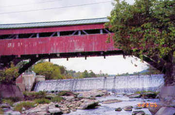
Photo by Tom Keating
September 23, 2005
![Frank Lewis Bridge [WGN 45-14-116]](ultimate_tour_2005/frank-lewis_keating_05092301.jpg)
Photo by Liz Keating
September 23, 2005
![Blow-me-down Bridge [WGN 29-10-10]](ultimate_tour_2005/blow_keating_05092301.jpg)
Photo by Liz Keating
September 23, 2005
![Upper Falls Bridge [WGN 45-14-08]](ultimate_tour_2005/upper-falls_keating_05092301.jpg)
Photo by Liz Keating
September 23, 2005
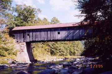
Photo by Liz Keating
September 23, 2005
![Bowers Bridge [WGN 45-14-11]](ultimate_tour_2005/bowers_keating_05092301.jpg)
Photo by Liz Keating
September 23, 2005
![Salmond Bridge [WGN 45-14-05]](ultimate_tour_2005/salmond_keating_05092301.jpg)
Photo by Liz Keating
September 23, 2005
Part XI
Hi Folks,
After checking in at the Quality Inn in Brattleboro, Vermont, on September 23rd, we visited the Best and Titcomb bridges.
On Saturday, the 24th, we rode the "Rutland Limited," a Green Mountain all-day train from Bellows Falls to Rutland. There was a 90-minute stopover in Rutland. On the return trip the train stopped at the Bartonsville bridge and half the passengers got out to photograph it. The Worrall bridge picture was taken from the train.
On the 25th we drove to Wilton, New Hampshire and rode the Wilton Scenic Railroad. Since it was only a two hour ride we visited the New Hampshire bridges Carlton, Combs, Slate and Ashuelot.
The Slate was completely destroyed by fire in 1993 and rebuilt in 2001 (sign on bridge). Ashuelot bridge is very attractive--white on the inside and outside with a red roof for a striking contrast. There was a historical sign indicating that it had been completely reconstructed. Notice the twin pedestrian walkways. The picture of the inside latticework is very attractive. A similar picture was on the opening page of the New Hampshire travel website last year when I first started research on this trip.
Tom
![Best's Bridge [WGN 45-10-10]](ultimate_tour_2005/best_keating_05092301.jpg)
Photo by Liz Keating
September 23, 2005
![Titcomb Bridge [WGN 45-14-04]](ultimate_tour_2005/titcomb_keating_05092301.jpg)
Photo by Liz Keating
September 23, 2005
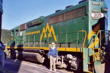
Photo by Liz Keating
September 24, 2005
![Bartonsville Bridge [WGN 45-13-11]](ultimate_tour_2005/bartonsville_keating_05092401.jpg)
Photo by Liz Keating
September 24, 2005
![Worrall Bridge [WGN 45-13-10]](ultimate_tour_2005/worrall_keating_05092401.jpg)
Photo by Liz Keating
September 24, 2005
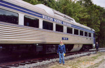
Photo by Liz Keating
September 25, 2005
![Carlton Bridge [WGN 29-03-07]](ultimate_tour_2005/carlton_keating_05092501.jpg)
Photo by Liz Keating
September 25, 2005
![Combs Bridge [WGN 29-03-03]](ultimate_tour_2005/combs_keating_05092501.jpg)
Photo by Liz Keating
September 25, 2005
![Slate Bridge [WGN 29-03-06]](ultimate_tour_2005/slate_keating_05092501.jpg)
Photo by Liz Keating
September 25, 2005
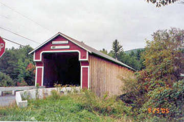
Photo by Liz Keating
September 25, 2005
![Ashuelot Bridge [WGN 29-03-02]](ultimate_tour_2005/ashuelot_keating_05092501.jpg)
Photo by Liz Keating
September 25, 2005
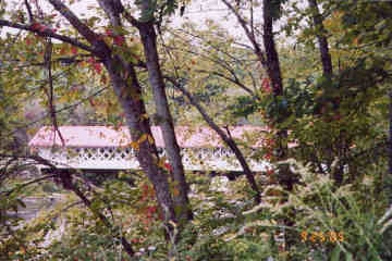
Photo by Liz Keating
September 25, 2005
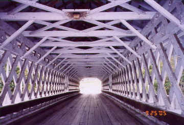
Photo by Liz Keating
September 25, 2005
Part XII
Hi Folks,
This is the end of my travelogue. On Monday, September 26, we visited the Green River, West Dummerston, Scott, Williamsville, Kidder Hill and Hall bridges in Vermont. There are two photos of the Green River Bridge. Jacksonville Stage Road is now Stage Road, if you are using Ed Barna's book.
There are also two pictures each of the West Dummerston and Scott bridges. The Scott has been bypassed. It has a town lattice with an added arch and two kingpost spans--a little bit of everything! The arch, added for extra support, is visibly bent because of the weight. The Hall bridge was rebuilt by Milton Graton in the 1990's.
We then crossed into New Hampshire and visited McDermott and Prentiss bridges, both bypassed. The McDermott must have been in serious danger of collapse--that is one very big steel beam!!
On Tuesday the 27th we headed home, tired yet happy--after visiting 110 covered bridges and riding four trains.
Tom
![Green River Bridge [WGN 45-13- 04]](ultimate_tour_2005/green-river_keating_05092601.jpg)
Photo by Liz Keating
September 26, 2005
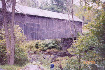
Photo by Liz Keating
September 26, 2005
![West Dummerston Bridge [WGN 45-13-02]](ultimate_tour_2005/wdummerston_keating_05092601.jpg)
Photo by Liz Keating
September 26, 2005
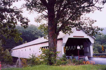
Photo by Liz Keating
September 26, 2005
![Scott Bridge [WGN 45-13-13]](ultimate_tour_2005/scott_keating_05092601.jpg)
Photo by Liz Keating
September 26, 2005
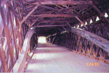
Photo by Liz Keating
September 26, 2005
![Williamsville Bridge [WGN 45-13-05]](ultimate_tour_2005/williamsville_keating_05092601.jpg)
Photo by Liz Keating
September 26, 2005
![Kidder Hill Bridge [WGN 45-13-03]](ultimate_tour_2005/kidder-hill_keating_05092601.jpg)
Photo by Liz Keating
September 26, 2005
![Hall Bridge [WGN 45-13-07]](ultimate_tour_2005/hall_keating_05092601.jpg)
Photo by Liz Keating
September 26, 2005
![McDermott Bridge [WGN 29-10-06]](ultimate_tour_2005/mcdermott_keating_05092601.jpg)
Photo by Liz Keating
September 26, 2005
![Prentiss Bridge [WGN 29-10-07]](ultimate_tour_2005/prentiss_keating_05092601.jpg)
Photo by Liz Keating
September 26, 2005
