Touring Switzerland with the Keatings
Part I
Hi Joe,
This is the first part of a multi message travelogue on our trip to Switzerland. Liz took 264 pictures. I selected 40, 2/3rds are covered bridge pix and the balance are pictures characteristic of Switzerland. All pictures, except for a couple (with Liz in photo) were taken by my wife, Lisette. I took the ones with her in them.
We arrived in Zurich on April 20. We met our tour guides, Carl Fowler and Jan Brink at the airport. We then took the train to central Zurich, transferred to another train to Chur (pronounced "Kur") and checked in to our hotel. Carl Fowler, our chief guide and VP of Rail Travel Center, advised us that we could take a no-additional cost cog rail trip (each of us had a Swiss 1st class rail/bus pass) to Arosa, a pretty town high in the mountains. Liz and I elected to take the trip. It was snowing when we got there!! Along the way, Liz took a picture of the St. Peter Bahnhof (bahn=train, hof=house). Note the roof not 50/50 but 70/30. I guess it had something to do with the snow. She also took a picture of a building with "sgraffiti". Many Swiss buildings have these drawings.
On April 21, we went to St. Gallen and then to Appenzell. Appenzell is in the mountains and is reachable via a cog railway (see photo). Appenzell has some rather gruesome drawings of a battle between the Appenzellers and the Austrians that took place about 700 years ago. All the Austrians were killed. Although I was not aware of this history, the Austrians ruled eastern Switzerland for a while. In the William Tell myth (William Tell was not a historically verified person, according to Carl), it was an Austrian nobleman, who forced Tell to shoot the apple off his son's head as punishment for not doffing his hat to said nobleman. Tell subsequently murdered the nobleman.
On April 22, we took the Bernina Express to Tirano, Italy. See the photo of the famous Landwasser Viaduct, built in 1902, part of the Bernina Express. Tirano is a pretty little town. On April 23, we went to the Mainau Gardens, located on an island in the Bodensee (Lake Contance)--see photo.
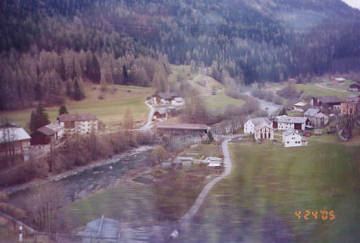
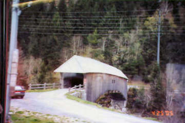
On April 24, we went to Davos. Along the way, we went thru a concrete bridge built in a covered bridge style (see photo). This bridge is a railroad bridge over the Landquart river at Klosters. Next photos are of two covered bridges, SZ-10-15, near Churwalden on Rt#3, over the Eggatobel river (taken thru a bus window). SZ-10-12 is south of Rt 19, over the Vorderrhein river, near Rueun.
Tom
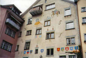
Photo by Liz Keating
April 20, 2005
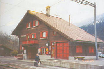
Photo by Tom Keating
April 20, 2005
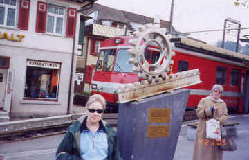
Photo by Tom Keating
April 21, 2005
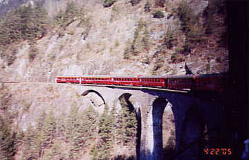
Photo by Liz Keating
April 22, 2005
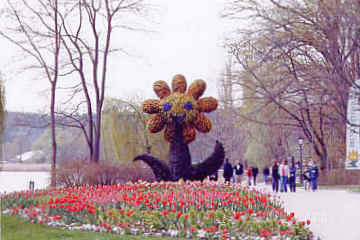
Photo by Liz Keating
April 24, 2005
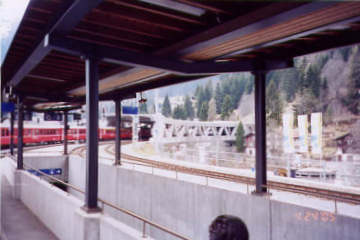
Photo by Liz Keating
April 24, 2005
near Churwalden over Eggatobel R.
Photo by Liz Keating
April 24, 2005
over Vorderrhein R.
Photo by Liz Keating
April 24, 2005
Part II
Hi Folks,
On April 25, we moved from Chur to Locarno. On 4-26, we visited gardens on the island of Brissago. On April 27, we visited Lugano and Swissminiatur, which has miniature castles, churches and two covered bridges. On April 28 we visited gardens on the islands of Madre and Bella, using a hydrofoil boat to get there. However, there were no actual covered bridges, so no pictures.
On April 29, we went to Domodossola, Italy and then to Brig, and Reichenbach where we passed two covered bridges. The sunrise picture is over Lake Brienz from our hotel near Interlaken. The two Reichenbach bridges are over the Kander river, SZ-06-27 and 28. We passed by them twice, and Liz chose the best pictures from the train. After a while, several people in our group would yell out"Covered Bridge!" and Liz became known as "The Covered Bridge Lady." There was also a "Cow Lady." The first week of our trip she lamented that there were no cows (it was cold and rainy). But then it turned sunny and warm, and we saw many cows. However some members of our group kept calling out "Cows" far longer than necessary (not Liz or I--too busy looking for covered bridges).
On April 30, we took the Gornergrat train to the Gornergrat summit for a beautiful view of the Matterhorn. We then went to Zermatt, passing by two 15th century stone bridges (see photo). We passed by another covered bridge near Zermatt, in the Valais canton. Zermatt has no cars, other than service and emergency vehicles.
On May 1, we went to Luzern. The first thing we saw was the Swiss national monument, a dying lion. This is a memorial to the Swiss guards of French King Louis XVI, who were murdered defending him from the mob. Switzerland stopped sending out mercenary soldiers after this incident, with the exception of the Papal Swiss Guards. Mark Twain called this monument"The most mournful sight my eyes ever did see."
Tom
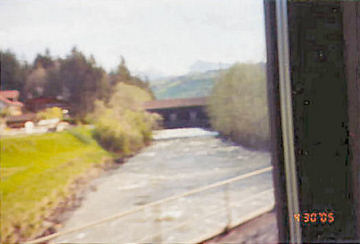
Photo by Liz Keating
April 30, 2005
Photo by Liz Keating
April 30, 2005
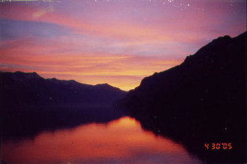
Photo by Liz Keating
April 30, 2005
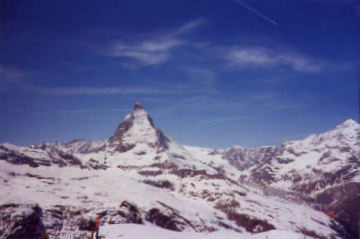
Photo by Liz Keating
April 30, 2005
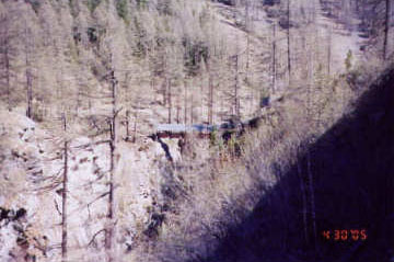
Photo by Liz Keating
April 30, 2005
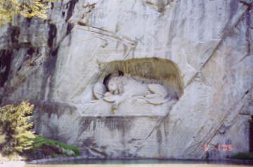
Photo by Liz Keating
April 30, 2005
Part III
Hi Folks,
While walking in Luzern, we saw police everywhere. It was May 1st, a traditional day of labor demonstrations in Europe, and a big Communist party day. When I say we saw police everywhere, I mean four or five at each corner, dressed in riot gear, with helmets, shields, body armour and carrying automatic rifles . We did not see any confrontations, but two members of our group, who stayed in old town while we went to the transport museum, did see a police SUV drive into some demonstrators.
Liz was thrilled to be able to walk thru the Kapellbrücke (see 1st four pictures). This bridge burned in August of 1993. Only a small portion was saved. The roof had drawings hanging down from each section, but most of these were destroyed and copies now hang in their place. A couple of burned out drawings are still in place. You can see a corner of one of them in the interior picture. Liz said between the rafters and the lighting, she could not get a better picture. One of our group had a more sophisticated camera and took some shots of these drawings. She promised us scans. Carl said the bridge was part of the city's defenses and he pointed out a wall that encircled the old town. This bridge was built in 1333, and was Europe's oldest covered bridge. Carl says that the Swiss invented the covered bridge.
Next we walked to the Jesuit church (Jesuitenkirche). I graduated from a Jesuit high school (the same one discussed in Tim Russert's book"Big Russ and Me") so I found this interesting. There was a service going on while we entered, so Liz did not take any pictures.
Then we walked to the Spreuerbrücke (see photos). The Spreuerbrücke was never damaged by fire, so the drawings hanging from the roof are the originals. They depict the "Dance of Death" and are rather gruesome. You can see the bottoms of some of them in the interior shot. The final picture is of a drawing on a Luzern building in the old town.
Tom
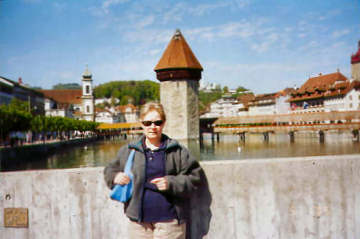
Photo by Tom Keating
May 1, 2005
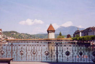
Photo by Liz Keating
May 1, 2005
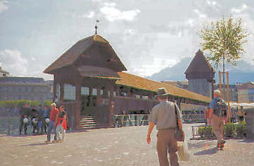
Photo by Liz Keating
May 1, 2005
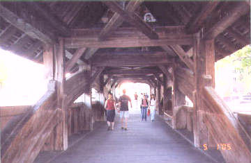
Photo by Liz Keating
May 1, 2005
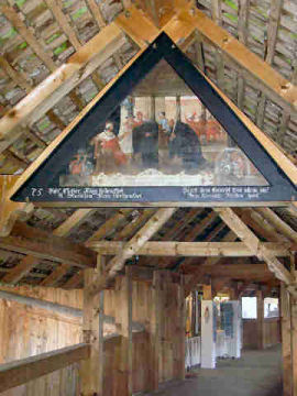
Photo by Gregor Wenda
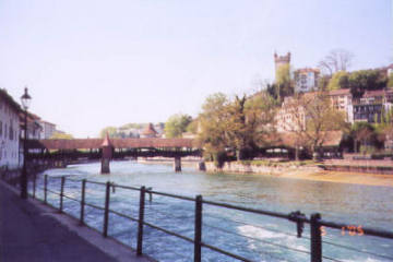
Photo by Liz Keating
May 1, 2005
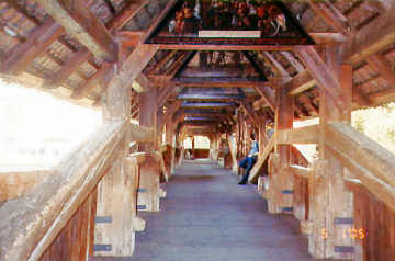
Photo by Liz Keating
May 1, 2005
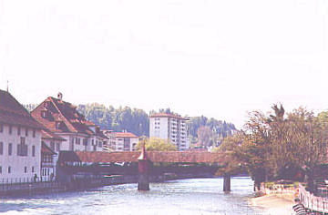
Photo by Liz Keating
May 1, 2005
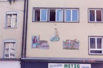
Photo by Liz Keating
May 1, 2005
Part IV
Hi Folks
Sunday, May 2 was a free day. Carl and Jan led separate groups on trips into the mountains around Interlaken. Liz and I decided to go on a covered bridge hike. I acquired the directions for this hike from the moderator of this website, Joe Nelson, and Liz and I both thank him. We explained to Carl what we wanted to do. He got out two very big books--timetables for the Swiss rail and postbus systems respectively. Our hike was from Eggiwil to Emmenatt. Carl laid out our personal timetable from Interlaken:
- 7:42 bus to Interlaken Ost Bahnhof
- 7:56 train to Bern
- 9:12 train to Signau on the S-bahn
- 9:48 bus to Eggiwil
(It turned out that there was no 9:48 on Sunday--waited until 10:18) Swiss guarantee one train per hour and 1 bus per hour. All these bridges are in Bern canton. The bus driver studied my Swiss rail/bus pass a long time. I'm not sure, but I don't think that he sees too many of them.
All the bridges were over the Emme river, except Dorfli, SZ 06-62, over the RothenBrook, in Eggiwil. There are two photos of Dorfli, One in shade, and one in sun (taken from opposite sides of the bridge).
Next came the Dieboldswil bridge, SZ 06-17, also two photos and a bonus photo of cows next to this bridge with traditional Swiss cowbells. The Aeschau bridge, SZ 06-15 is next. All bridges had a sign, with diagrams showing construction details. The signs were in German. All of the bridges also had a number. We missed the Brunnmatt Bridge--you had to leave the roadway on what the hiking directions called an "adventure trail." We saw 1 footpath, called a "Wander Weg", but did not see a covered bridge and passed it by. Of the 8 bridges on the hike, we found 5. The final two are Bubenbrucke, SZ 06-14 and Hornbenbrucke, SZ 06-16. By this time, we were hot, tired, and sunburned (85 degrees this day), and elected to get on the postbus at Schupbach, back to Signau. The guy with the orange backpack in the Bubenbrucke picture is me.
So much for our hike in the Emme river valley (Emmenthal= valley of Emme) where they make the famous cheese. Cows were everywhere. Sometimes the smell was pretty strong.
Tom
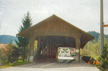
Photo by Liz Keating
May 2, 2005
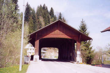
Photo by Liz Keating
May 2, 2005
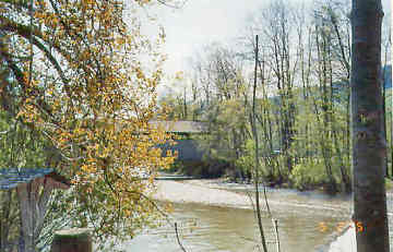
Photo by Liz Keating
May 2, 2005
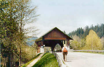
Photo by Liz Keating
May 2, 2005
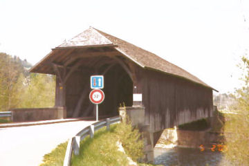
Photo by Liz Keating
May 2, 2005
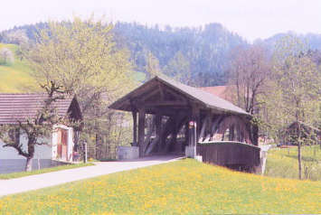
Photo by Liz Keating
May 2, 2005
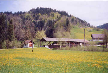
Photo by Liz Keating
May 2, 2005
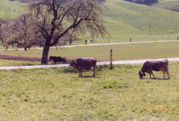
Photo by Liz Keating
May 2, 2005
Part V
Hi Folks
On May 3, we took the train from Interlaken to Spiez, then to Montreux. There were six covered bridges along the railroad route between Spiez and Zweisimmen.
Liz stationed herself at an open window and snapped away. Liz looked in her covered bridge list and determined that they are all in the Simme river valley. She decided that she had pictures of six of ten as follows: Sz 06-29 thru 38. The bridge labeled Simme 6 and 7 reminded me of the concrete covered bridge. It is new and has a metal roof. The last photo, of SZ 24-02, is of a covered bridge at the Chateau de Chillon, located on Lake Geneva (Lac Leman). Liz's guide does not give a date, but the Chateau pamphlet dates the bridge as 18th century. Liz's guide says that it has a Stringer support.
On May 4 we flew home, tired and happy. Liz found 21 covered bridges and I rode on many trains.
Tom
[*The identity of these bridges is uncertain. Advice from a knowledgeable person would be gratefully accepted - Ed]
Photo by Liz Keating
May 3, 2005
Photo by Liz Keating
May 3, 2005
Photo by Liz Keating
May 3, 2005
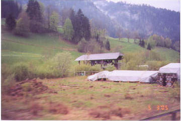
Photo by Liz Keating
May 3, 2005
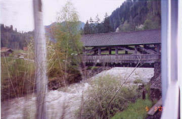
Photo by Liz Keating
May 3, 2005
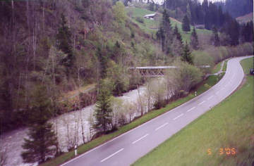
Photo by Liz Keating
May 3, 2005
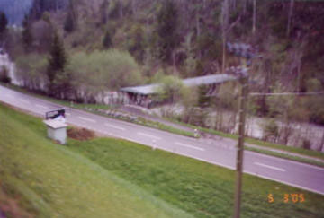
Photo by Liz Keating
May 3, 2005
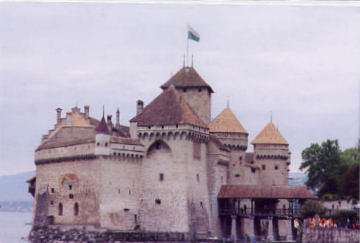
Photo by Liz Keating
May 3, 2005
Part VI
Dear Mr. Meyer-Usteri:
A friend has shared his photo tour of Switzerland with us for posting on www.vermontbridges.com Because he and his wife took many of their photos of the covered bridges through the window of a railroad coach, the identity of [some of] those bridges is in doubt. We would be grateful to you if you would view the article "Touring Switzerland with the Keatings," and name the bridges for us.
Yours in bridging,
Joe Nelson
Commentary on Touring Switzerland with the Keatings
by Konrad Meyer-Usteri, Switzerland
Dear Joe:
I worked through the Keating's report about their "Touring in Switzerland". It is amazing what they all have visited in only two weeks. Especially I am surprised about the hike deep in the Emmental, where they have also seen many milk-cows for the Emmental cheese and of course could "touch" excellent examples of Swiss covered bridges.
Out from the train in the Simmental some CB's are mixed up and it is not easy to put the photo and the right name together. I hope . . . you can open and make use of [my attachment] with some of my photos.
On the way up to Zermatt Mrs. Keating got a rare glimpse of the Hohsteg-Bridge, not in the World Guide, through an avalanch-gallery 2 miles north of Zermatt in the direction of Täsch-Visp. In 1985 this C.B. was rebuilt for pedestrians (Wanderweg) with two glued-laminated girders.
On the way back to Interlaken the 1st photo shows S-06-27, the Rüdlebrügg the 2nd photo S-06-28 the humpback called Schützenbrücke, both in the community/ location of Reichenbach on the river Kander.
Two very nice photos show in Eggiwil the Dörflibrücke across the Roethenbach, with nr. S-06-62 built in 1985 in completely new technique instead of the old bridge of 1885. S-06-17, Eggiwil, Emme, Dieboldswilbrücke, built in 1887, reinforced by two arches in 1979.
S-06-14 Signau/Schüpbach, Emme, Bubeneibrücke, 165' long, built in 1988 our 2nd and last example of new wooden bridge in new technique but in the historic form with roof; it did cost us just 55% more than the same bridge in concrete. The next, new wooden bridges have new forms.
S-06-16 Eggiwil Emme Horbenbrücke posted for 32t = 70,000lbs, 147' 1834, but reinforced 1990, the inside shows the skillful timberwork.
The Keatings missed two well preserved bridges, of which I give pictures below, the last one is in very bad shape, and a new wooden bridge will be built, as soon the court "puts the lights on green".
S-06-09 Signau Emme Schüpbachbrücke, posted 28t= 62,000lb, 175' built 1839 and several times reinforced, it will keep the full load of today for many years (old nr.10). Photo Below.
Not yet in the World Guide: We moved the old Bubeneibrücke built in 1838 2 miles down the Emme and rebuilt it in 1991. It has 1 span, long 132'; still used for pedestrians and bikes. It is called now Brunnmattbrücke on the Emme in the communities Signau and Lauperswil.
Yours in bridging,
Konrad
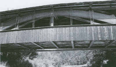
Photo by Konrad Meyer-Usteri
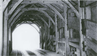
Photo by Konrad Meyer-Usteri
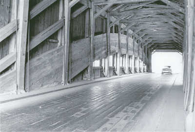
Photo by Konrad Meyer-Usteri
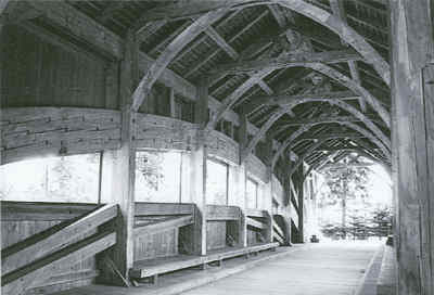
Photo by Konrad Meyer-Usteri