The Keatings Explore New Brunswick
Part I: Getting There
Hi Folks,
On Sept 18, Liz and I departed for New Brunswick, Canada to visit some of it's 63 covered bridges. We stopped in Wilton, Maine the first night, in order to ride the Sandy River and Rangely Lakes RR, between Phillips and Sanders, Maine(see photos with me and engine and one of the train). I have also attached pictures of their sign, one of Liz inside the passenger car and a closeup of the beveled glass window.
I like to ride trains and we did not expect to see any covered bridges on this train trip. However it turns out that the railroad once owned a covered bridge which crossed the Sandy River. The line now stops at the river. A railroad volunteer guide(it is an all volunteer operation) led us to the bridge abutment and showed us a picture of the long gone bridge. I realize that a picture of a picture is imperfect, but it is better than nothing.
The guide said the a scrap company bought the rights to all RR property in the 1930s. The rails were sold to a Japanese company (we probably got it back at Pearl Harbor). They thought that the bridge was taken down in the 1930s but an older woman passenger told them it was still there in 1939 where she and her boyfriend spent some romantic time. I asked the guide if he knew the name of the bridge. He said it was known as the SRRL RR covered bridge.
The volunteer said that the railroad would like to build a new covered bridge. They have a commitment from a local lumber company, which will provide free lumber, plus local skilled carpenters who will donate time. He said that the bridge would be free. However, they must first buy the property on the opposite side of the river and were hoping for donations. If they rebuild it, it will one of two railroad covered bridges in the USA currently used by a train. The other is at Clark's Trading Post, Lincoln,NH
Their website is http://www.srrl-rr.org.
The street address is:
The Sandy River and Rangely Lakes Railroad
P.O. Box B
Phillips, Maine 04966.
If you don't want to donate, you might want to ride the rr--about 1 hr round trip.
Tom
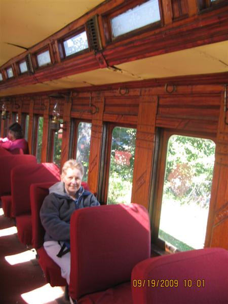
Photo by Tom Keating
September 19, 2009

Photo by Liz Keating
September 19, 2009
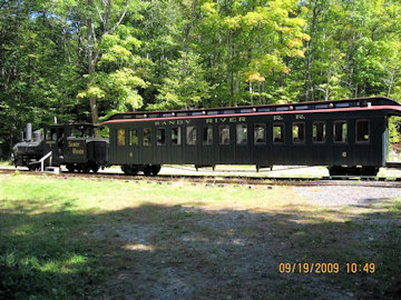
Photo by Liz Keating
September 19, 2009
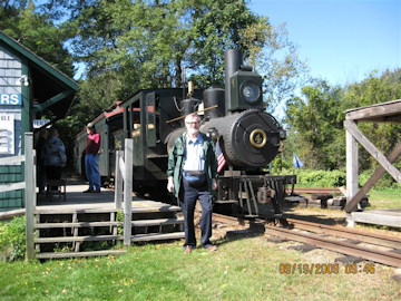
Photo by Liz Keating
September 19, 2009
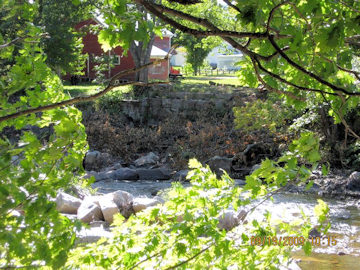
Photo by Liz Keating
September 19, 2009
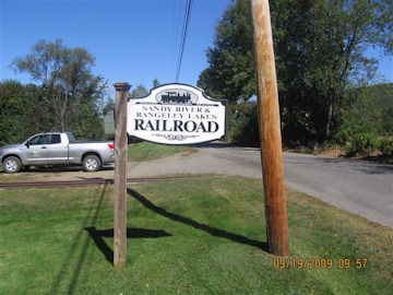
Photo by Liz Keating
September 19, 2009
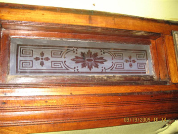
Photo by Liz Keating
September 19, 2009
Part II: Getting There: Maine CB's
Hi Folks,
After our train trip, we headed towards New Brunswick planning to visit the last three of Maine's covered bridges that we had not yet seen--Low's, Robyville, and Watson.
I have attached three pictures of Low's bridge, two of which show the abutments in detail, and of a sign giving the history of Low's bridge, with pictures of previous bridges.
I have also attached three pictures of Robyville, one with abutment detail and one with Liz. The Robyville bridge is the only one in Maine with a shingle roof and Ben and June Evans, author's of a New England covered bridge book, believe that it is the only one in New England completely covered on the sides and portals with shingles.
Finally, I have attached two pictures of the Watson bridge. The pictures are not in order, because some were taken by me and some by Liz.
We entered New Brunswick, Canada about 7 pm, which became 8 pm Atlantic Standard time. We had a reservation at the EconoLodge in Woodstock, New Brunswick for three nights.
Tom
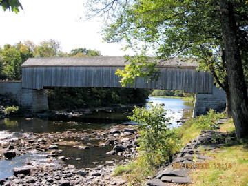
Photo by Liz Keating
September 19, 2009
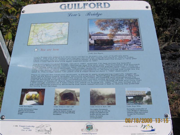
Photo by Liz Keating
September 19, 2009
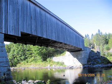
Photo by Liz Keating
September 19, 2009
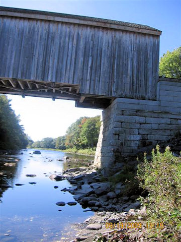
Photo by Liz Keating
September 19, 2009
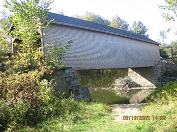
Photo by Liz Keating
September 19, 2005
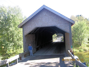
Photo by Liz Keating
September 19, 2005
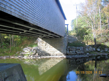
Photo by Tom Keating
September 19, 2005
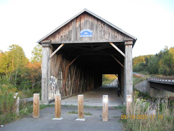
Photo by Liz Keating
September 19, 2005
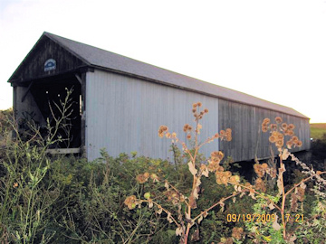
Photo by Liz Keating
September 19, 2005
Part III
Hi Folks,
On Sunday, Sept. 20, we took the Trans Canada Highway (Rte 2) to Hartland, to visit the longest covered bridge in the world at 1282 ft-it's been on Liz' wish list for a while.
I have attached two pictures of the Hartland bridge, one with Liz, and pictures of the two plaques. The bridge is easy to find, with signs on Rte 2 leading you to the bridge. We parked and walked across the bridge (it has a sidewalk). It is a one-lane bridge without a traffic light. You turn your headlights on and look for headlights at the other end before you cross.
There is an information center in Hartland at the end of the bridge. I asked the lady if they had any covered bridge tour pamphlets. She only had Carleton county (Hartland -Woodstock) tour brochures, which I gratefully accepted. There is a gift shop between the bridge and Rte 2. We stopped there and Liz bought, among other things, some "Covered Bridge potato chips."
We then drove north to Victoria county and Tomlinson Mill bridge. I think the roofed window is interesting.
We continued north, stopping in Grand Falls to see the Grand Falls, not very grand at this time (see photo). We were now in French Canadian territory. I asked directions from some teenagers, who responded in French that I couldn't understand (40 years since college French). New Brunswick is very proud that it is the only official bilingual province in Canada. All road signs are in French and English or pictographs. One pictograph that I remember on Rte 2 at the approach to a bridge was of a car sliding across 2 lanes, next to a thermometer with the bottom half bright red. I Believe that the English equivalent would be "Bridge freezes before highway."
We drove north and east on rte 2 into Madawaska county (which calls itself "The Republic of Madawaska"). We visited Boniface, and Baker Brook bridges. Baker Brook has been bypassed. Baker Brook is the farthest north that we have been to visit a covered bridge. It is west of Edmunston, located in the finger of New Brunswick sandwiched between the top of Maine and Quebec. We also tried to visit Quisibis River #2 but the road was closed for construction about 3 miles away from the bridge and Liz said "No way am I walking 3 miles for this bridge!"
We then headed back to our motel in Woodstock.
Tom
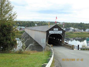
Photo by Liz Keating
September 20, 2005
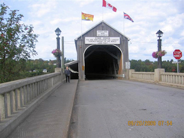
Photo by Tom Keating
September 20, 2005
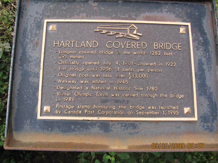
Photo by Tom Keating
September 20, 2005

Photo by Tom Keating
September 20, 2005

Photo by Liz Keating
September 20, 2005
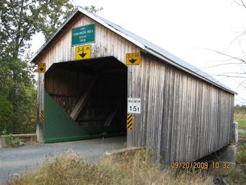
Photo by Tom Keating
September 20, 2005
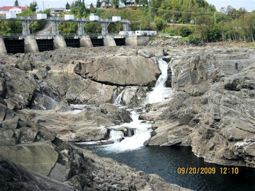
Photo by Liz Keating
September 20, 2005
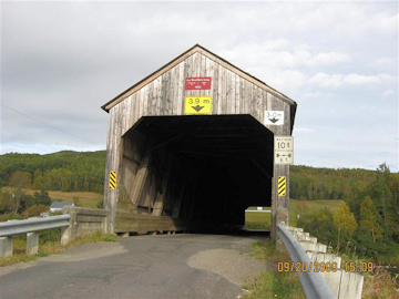
Photo by Liz Keating
September 20, 2005
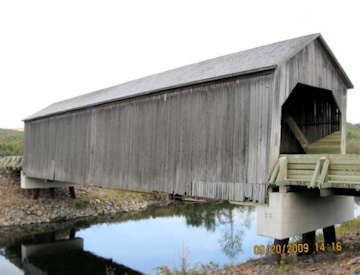
Photo by Liz Keating
September 20, 2009
Part IV
Hi Folks,
On Monday, September 21, we decided to take the Carleton County covered bridge tour, using the pamphlet given to us at the Hartland info center. The first bridge on the list is the Adair bridge, built in 1948 and recently renovated. Unfortunately, some terrible person set fire to it since we visited it and it was a total loss. See this link for coverage: Adair Bridge Burned.
The province of New Brunswick has a policy of not replacing covered bridges if they are destroyed. Our picture may be the last one taken of this bridge. The RCMP has said the fire was arson, but don't have a suspect.
The next bridge, Nackawick, was not on the tour but close by in York county. This may not have been a good move, as it was down a terrible dirt road, which I took when I saw a covered bridge sign. We ended up turning around and going back after banging the bottom of our car. I went to a service station afterwards and they said that I had dented my flexpipe-part of the exhaust pipe. They told me that they didn't have time to fix it and that I could make it home ok. I took it to get fixed when we got home-cost $200. Mufflerman told me that the rest of the exhaust system would only last another year. The car is 12 yrs old so I don't feel too bad. We were able to get to Nackawick via another dirt road, not quite as bad as the first one. There are two photos of Nackawick, one with me.
We then drove back to Carleton county and Mangum bridge. There are two photos of Mangum, one of which shows the timber/dry stone abutment. This was the first time that I had seen this type of abutment. Several of New Brunswick's bridges have this type of abutment.
The next bridge on the tour was Ellis. One photo is of Ellis straight on, and another shows the all-timber abutment.
Florenceville, the next bridge, is a combined wooden covered and steel truss bridge, similar to Harpersfield bridge, Ashtabula County, Ohio.
The final bridge is Benton, which has been bypassed, and is in a little park. I have attached five photos of Benton, two side, one front, one underside, and one close up of the dry stone/timber abutment. I was able to get underneath this bridge, thus the extra photos.
Tom
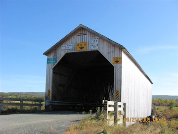
Photo by Liz Keating
September 21, 2009
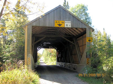
Photo by Liz Keating
September 21, 2005
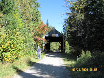
Photo by Liz Keating
September 21, 2005

Photo by Liz Keating
September 21, 2005
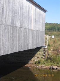
Photo by Liz Keating
September 21, 2005
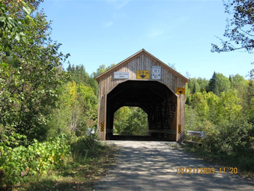
Photo by Liz Keating
September 21, 2005
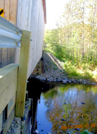
Photo by Liz Keating
September 21, 2005
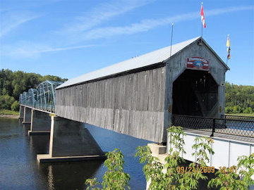
Photo by Liz Keating
September 21, 2009
Photo by Liz Keating
September 21, 2009

Photo by Liz Keating
September 21, 2009
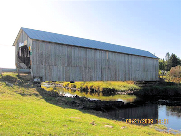
Photo by Liz Keating
September 21, 2009
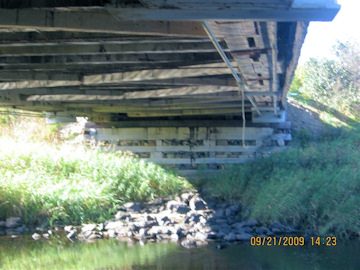
Photo by Liz Keating
September 21, 2009
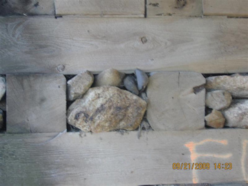
Photo by Liz Keating
September 21, 2009
Part V
Hi Folks,
On Tuesday, September 22, we left Woodstock for Sussex, New Brunswick, where we had a reservation for five nights at the Fairway Inn. I picked Sussex because it is close to Fundy National Park and is about the center of Kings County, which has the most, 16, covered bridges of all New Brunswick counties.
We stopped to see the Patrick Owens bridge in Rusagonis, Sunbury County on the way. I have attached two photos, one showing the open lattice side and one of the portal.
We exited Route 2 at exit 365 and there were signs leading us to the Covered Bridge Information Centre. I have attached two photos. One of the Centre and one of their sign. The Centre has a large assortment of brochures, including an excellent Sussex Regional map, showing 25 covered bridges. We have been using the New Brunswick Travel Guide and Dale Travis website for directions.
The Starkey bridge was only a short detour from our route to our motel in Sussex. After checking in at the motel, we went off to see nearby covered bridges: Tranton, Salmon, Oldfield and Plumsweep. I have attached two photos of Oldfield, showing both portals, one with Liz.
Tom

Photo by Liz Keating
September 22, 2005
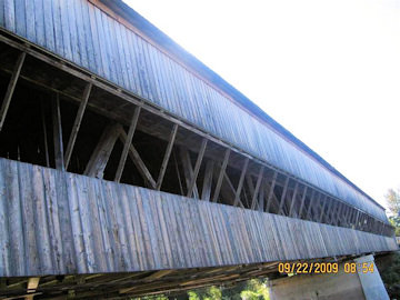
Photo by Liz Keating
September 22, 2005
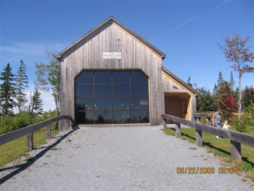
Photo by Liz Keating
September 22, 2005
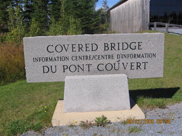
Photo by Liz Keating
September 22, 2005
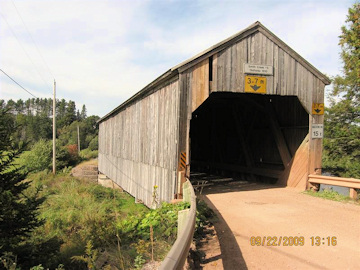
Photo by Liz Keating
September 22, 2005

Photo by Tom Keating
September 22, 2005
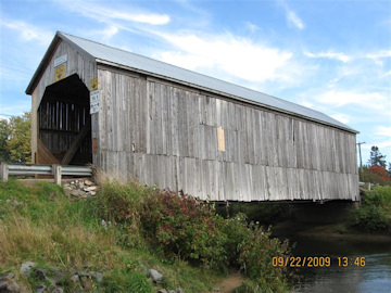
Photo by Liz Keating
September 22, 2005
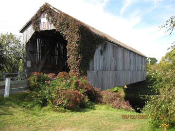
Photo by Tom Keating
September 22, 2005
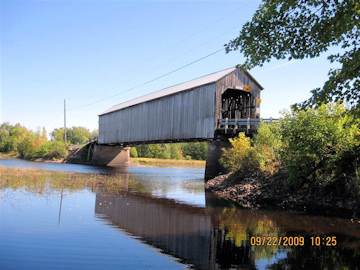
Photo by Liz Keating
September 22, 2005
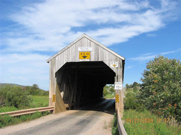
Photo by Tom Keating
September 22, 2005
Part VI
Hi Folks,
On Wednesday September 23, we drove to Fundy National Park. We walked several trails including the Caribou Plain trail. See the photo of Caribou Bog. Part of this trail is wheel chair accessible.
Next we drove to the Dickson Falls trail, about 30 minute away. We then drove to the Point Wolfe bridge, the only red covered bridge in New Brunswick. It was rebuilt by Canadian National Parks in 1992. I have attached three photos of the bridge, one of a sign with pictures of previous bridges and one of the view out to Fundy Bay from the bridge window.
From Fundy, we drove along the coast to the Cape Enrage Lighthouse, inside Chignecto Bay, a narrow arm of the Bay of Fundy. There was a sign at this automated lighthouse warning that the foghorn could go off at any time and could cause hearing damage. Finally, I have attached a picture of me next to the park entrance sign, taken a couple of days later.
Tom
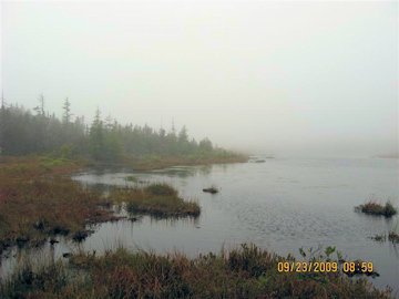
Photo by Liz Keating
September 23, 2009
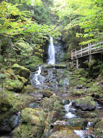
Photo by Liz Keating
September 23, 2009
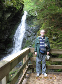
Photo by Liz Keating
September 23, 2009
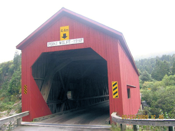
Photo by Liz Keating
September 23, 2009
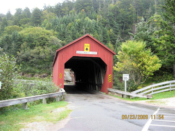
Photo by Liz Keating
September 23, 2009
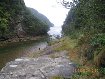
Photo by Liz Keating
September 23, 2009
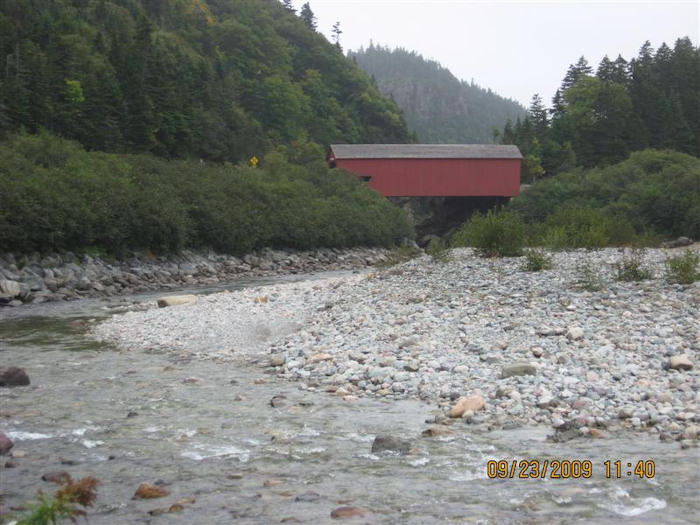
Photo by Liz Keating
September 23, 2009
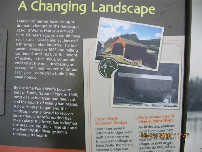
Photo by Liz Keating
September 23, 2009
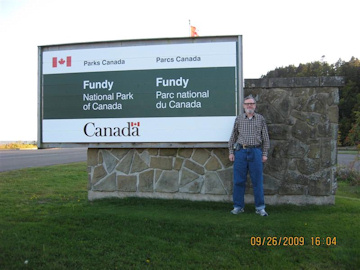
Photo by Liz Keating
September 23, 2009
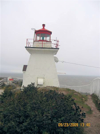
Photo by Liz Keating
September 23, 2009
Part VII
Hi Folks,
On September 24 we drove to Hopewell Rocks, that part of New Brunswick where the Chignecto bay ends at Shepody bay and Petitcodiac River. This is at the narrow end of a funnel and the result is very high tides. Hopewell Rocks pictures are usually shown on New Brunswick tourist ads, with the slogan "Come walk on the ocean floor!" There is a large sign at the entrance (many stairs down to the beach) warning you what time the tide will come back and urging you to leave the beach in time. It also said that if you were caught by rising water: "Do not Panic. Find a high spot and wait for 2-3 hrs."
I have attached six photos of Hopewell Rocks, for the benefit of scenery lovers (not everybody on the list is a covered bridger). There were two people sitting on lawn chairs reading books--employees who probably made sure everybody was back up before high tide.
In the afternoon, we visited three more bridges--Hartley Steeves, William Mitton, and Hasty. I have attached two photos of Mitton, one showing the abutment.
Tom
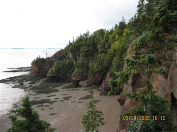
Photo by Liz Keating
September 24, 2009
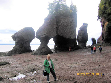
Photo by Tom Keating
September 24, 2009
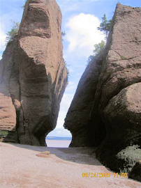
Photo by Liz Keating
September 24, 2009
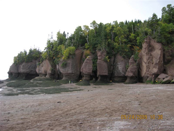
Photo by Liz Keating
September 24, 2009
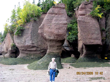
Photo by Tom Keating
September 24, 2009
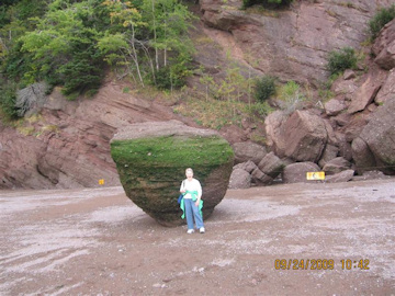
Photo by Tom Keating
September 24, 2009
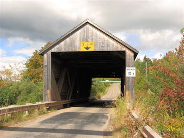
Photo by Liz Keating
September 24, 2009
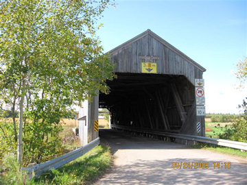
Photo by Tom Keating
September 24, 2009
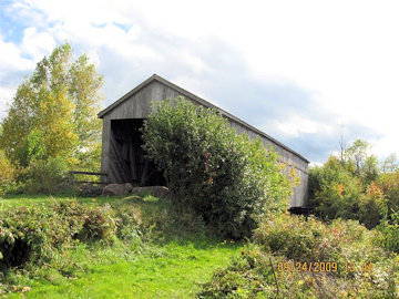
Photo by Liz Keating
September 24, 2009

Photo by Tom Keating
September 24, 2009
Part VIII
Hi Folks,
On Friday, September 25, we decided to spend the day finding as many as possible of the bridges shown on the Sussex regional map that we had not already visited.
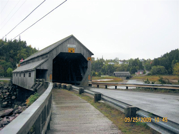
The first three bridges are the Urney, Moore's Mill, and McFarlane. Then we drove to St. Martin's, on the Fundy Bay coast
It is an attractive town, with two covered bridges; the Irish River and the Hardscrabble, both within sight of each other. There a replica lighthouse info center. There was a tour bus there with people from all over the US. The info center man explained that cruise ships dock in St. John and bring people to St. Martin's on tours. He also said it was the only place in the world where two covered bridges could be photographed together. I said: "Actually there is a place in Vermont where you can photograph two covered bridges together (Northfield--see previous travelogue, this website).
I have attached photos of the info center and both bridges. Next, we went to Darling's Island bridge, two photos, one showing a bypass barrier.
Tom
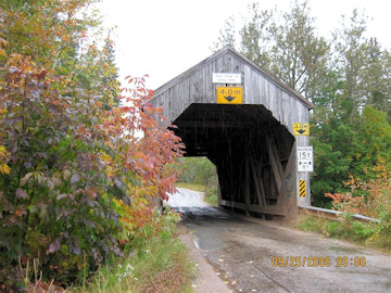
Photo by Liz Keating
September 25, 2009
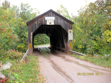
Photo by Tom Keating
September 25, 2009
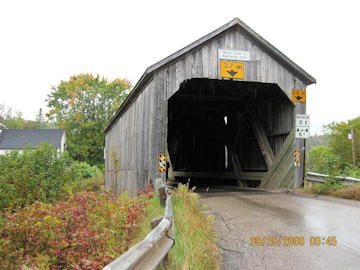
Photo by Liz Keating
September 25, 2009
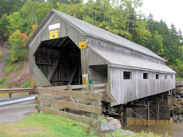
Photo by Tom Keating
September 25, 2009
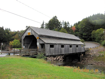
Photo by Liz Keating
September 25, 2009
Photo by Tom Keating
September 25, 2009
Irish Bridge in background
Photo by Tom Keating
September 25, 2009

Photo by Liz Keating
September 25, 2009
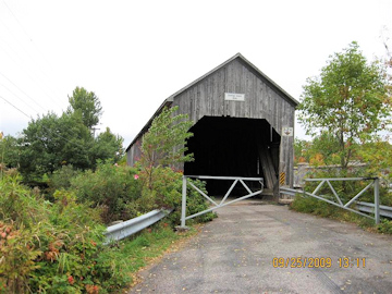
Photo by Tom Keating
September 25, 2009
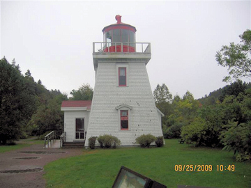
Photo by Liz Keating
September 25, 2009
Part IX
Hi Folks,
Continuing our trip on September 25, we saw these four bridges: Smithtown Road, French Village, Bloomfield, and Moosehorn.
There are three photos of Smithtown, including one of the underside, and two of French Village, including a portal shot. There are also three photos of Moosehorn, which was in a little park reached by a path going underneath Rte 1, a four-lane divided highway. There was a sign on Rte 1 telling you that this town was the home of the Moosehorn bridge.
YIB
Tom
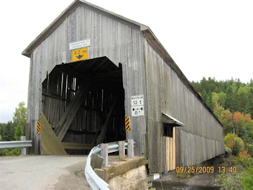
Photo by Liz Keating
September 25, 2009
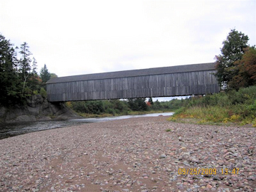
Photo by Tom Keating
September 25, 2009
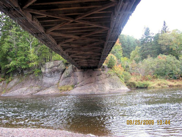
Photo by Liz Keating
September 25, 2009
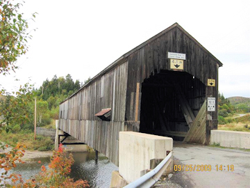
Photo by Liz Keating
September 25, 2009

Photo by Tom Keating
September 25, 2009
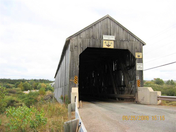
Photo by Liz Keating
September 25, 2009
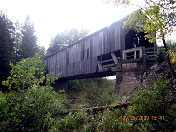
Photo by Liz Keating
September 25, 2009
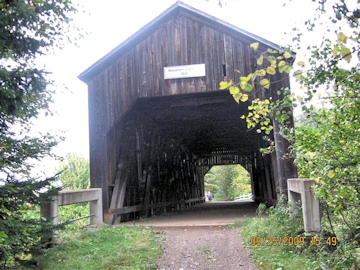
Photo by Tom Keating
September 25, 2009
Part X
Hi Folks,
On Saturday, September 26, we went to Fundy Park once more to walk some trails and visit Forty Five bridge, one of two owned and maintained by Fundy (Canada) Parks.
Forty-Five is on the north east border of Fundy and accessible via a dirt road. I checked with the Park visitor center to see if it was safe for a passenger car. The woman said it was and it was about a 20 minute drive.
There are three photos of Forty-Five: interior, portal and a side picture, with window. The Forty-Five view picture was taken from the Forty-Five window.
Next, there are two photos of Germantown, showing the formidable steel protective barrier--no errant trucks allowed! About half of the New Brunswick bridges that we visited had one of these barriers, but only on one side. The Concord bridge in Cobb County , Georgia recently damaged by a U-Haul truck had a similar barrier but only on one side.
Our next stop was Sawmill Creek bridge: see three photos: bridge, bridge with sign and bilingual sign.
Finally on the way home, we stopped at the New Brunswick RR museum, in Hillsborough. I have attached photos of their entrance sign, a fire fighting tank car and a serious snowplow. There was a plaque at the entrance, commemorating a battle in 1755 between the French/Acadians and the English soldiers sent to round them up and deport them. The Acadians won and the English never tried to deport anyone again from this part of New Brunswick.
YIB
Tom
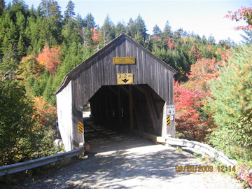
Photo by Liz Keating
September 26, 2009
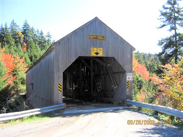
Photo by Tom Keating
September 26, 2009
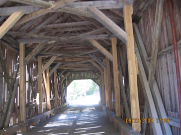
Photo by Liz Keating
September 26, 2009
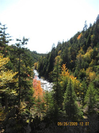
Photo by Tom Keating
September 26, 2009
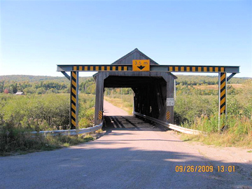
Photo by Liz Keating
September 26, 2009
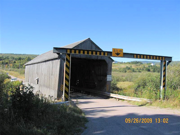
Photo by Tom Keating
September 26, 2009
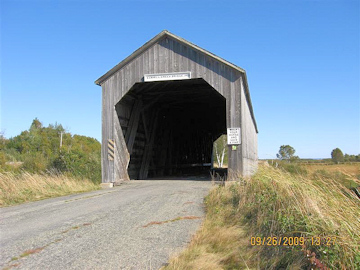
Photo by Liz Keating
September 26, 2009
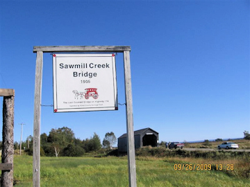
Photo by Tom Keating
September 26, 2009
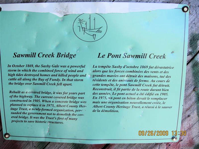
Photo by Liz Keating
September 26, 2009
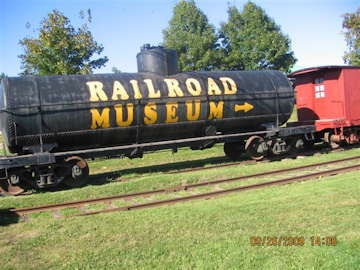
Photo by Liz Keating
September 26, 2009
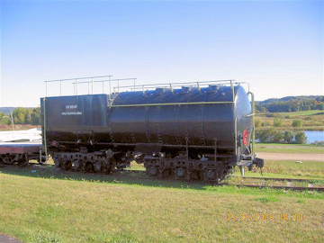
Photo by Tom Keating
September 26, 2009
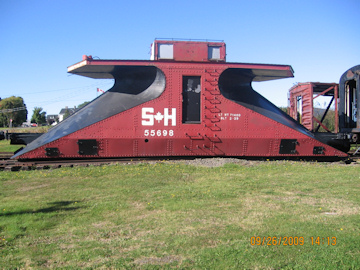
Photo by Liz Keating
September 26, 2009
Part XI
Hi Folks,
On Sunday, September 27, we left Sussex , headed for Richibucto, where we had a reservation for three nights at the Silver Birch Motel.
We stopped en-route to see the Sackville Waterfowl Park. This park was founded in 1988 as a joint venture between the Town of Sackville and Ducks Unlimited of Canada. The Province of New Brunswick, the Canadian Wildlife Service and the Delaware Duck Stamp Fund. There was a plaque set into a boulder commemorating the contribution of the Delaware Duck Stamp Fund.
The two hunters on my email list already know that hunters are conservationists, but the non hunters do not. President Theodore "Teddy" Roosevelt was probably the best known hunter/conservationist--brought out in the recent Ken Burns National Parks PBS series. Hunters know that if a species becomes extinct that you can't hunt them anymore. So this fund contributed money to this park as a stopover for ducks flying to Delaware. I am not a hunter, but read all the pamphlets at this park.
I recently read an article in "The Nature Conservancy" magazine by a naturalist who buys a US government duck stamp every year. He said that he was not a hunter, but bought the stamp because the money funded land purchases for the National Wildlife Refuges. I am attaching the best pictures of the birds that we saw; Red Wing Blackbirds-- the red wings on these birds can only be seen in flight. They landed every time I tried to get a picture of them flying, Female Gadwall, Red Winged Teal Ducks, and Ring Neck Ducks.
I asked directions on how to get to Tantramar bridge at the Sackville info center (two photos, one interior).
From there we drove to the Silver Birch Motel in Richibucto, arriving about 3pm. I picked this place from the New Brunswick Travel Guide because it was near Kouchibouguac National Park. There was no one in the office. The door was locked with a phone number to call. I called from a phone booth in front. It rang 12 times and then a recorded message started "If you would like to make a call...." We have decided that this place is not to be recommended.
We drove to Kouchibouuguac to occupy our time (see photo). We were finally able to check in at 5 pm and the manager was not apologetic. Liz said that she thought the room had not been vacuumed in a week.
The next morning we drove to Cameron's Mill bridge (two photos, one interior ) and then to Kouchibouguac Park, where we walked the Bog Trail in the morning. If there are any gardeners reading this, then you know about peat moss, which comes from New Brunswick. If you look at Liz vs. the peat bog (just one of many) then you realize just how much peat moss there is in New Brunswick. The picture of Liz looking at the sign was taken by me from the tower ( see photo of me in tower). The picture of me with the picnic table statues was taken by Liz at the visitor center.
YIB
Tom
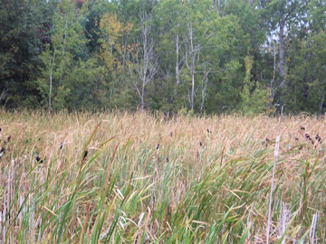
Photo by Liz Keating
September 27, 2009
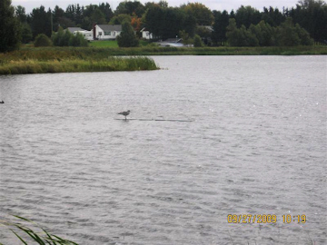
Photo by Tom Keating
September 27, 2009
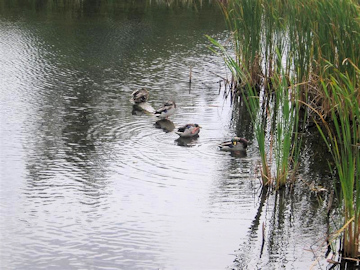
Photo by Liz Keating
September 27, 2009
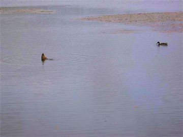
Photo by Tom Keating
September 27, 2009
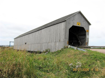
Photo by Liz Keating
September 27, 2009
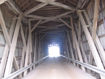
Photo by Tom Keating
September 27, 2009
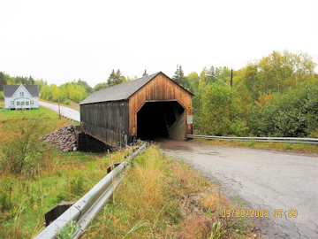
Photo by Liz Keating
September 27, 2009
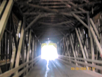
Photo by Tom Keating
September 27, 2009
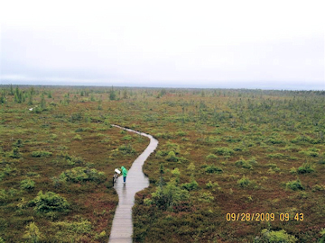
Photo by Tom Keating
September 27, 2009
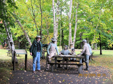
Photo by Liz Keating
September 27, 2009
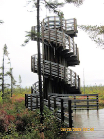
Photo by Liz Keating
September 26, 2009
Part XII
Hi Folks,
Continuing on September 28, we also saw a heron at Kouchibouguac. On September 29 we saw the Richibucto Lighthouse on the Northumberland Straight in Richibucto (see photos). I have also attached two photos of the Tom Graham bridge-- both portals.
On September 30 we left Richibucto, bound for St. John. We stopped along the way to see the Peter Jonah bridge, one of two in New Brunswick with hip/square roof portals. The other is in a private park in Doaktown. I have attached two photos, one side and one portal.
We arrived in St. John a little before noon. I took pictures of Liz in front of a replica lighthouse and some comic downtown statues. We checked in to our motel and planned the next day. Liz said she wanted to look at something other than covered bridges and I had a Lighthouse Route pamphlet showing locations of St. John River lighthouses.
The first place we saw on October 1 was the Bayswater bridge, two photos, side and portal. It is also the last bridge that we saw on this trip. Part 13 will be the conclusion.
YIB
Tom
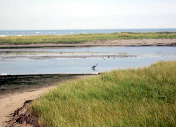
Photo by Tom Keating
September 28, 2009
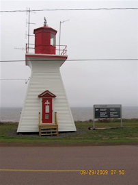
Photo by Liz Keating
September 28, 2009
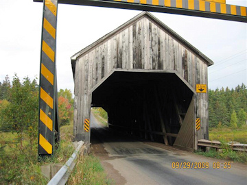
Photo by Liz Keating
September 28, 2009
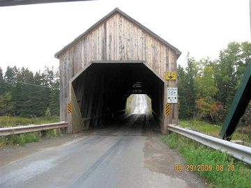
Photo by Liz Keating
September 28, 2009
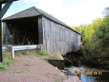
Photo by Liz Keating
September 28, 2009
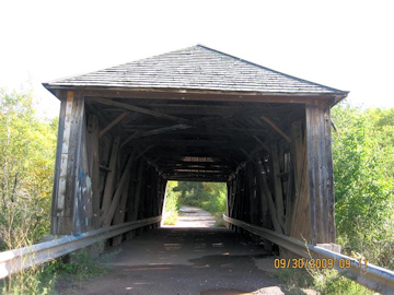
Photo by Liz Keating
September 28, 2009
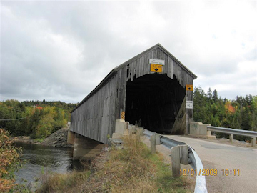
Photo by Liz Keating
September 28, 2009
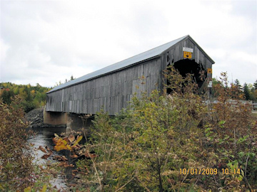
Photo by Liz Keating
September 28, 2009
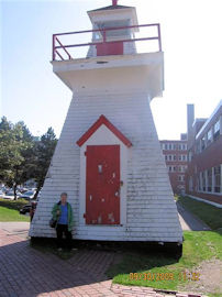
Photo by Tom Keating
September 28, 2009
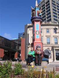
Photo by Tom Keating
September 28, 2009
Part XIII
Hi Folks,
This is a list of the lighthouses that we visited on October 1:
- Bayswater
- Sandpoint, tallest structure, on stilts, to survive spring floods
- Belyeas Point, with Liz
- Hampstead, Inactive, smallest
- Gagetown, on stilts
To get to these lighthouses, we had to use the Bayswater Ferry, toll free, run by the Province of New Brunswick. It is a cable ferry system and the cables are on the river bottom. I have attached photos of the ferry and an explanatory sign. I have also attached a photo of the Sand Point sign.
Lastly on October 2, we went to the Irving Nature Park, in St. John and saw several foxes (see photo).
On Oct 3, we headed for home arriving on the 4th.
That's all folks!
YIBTom
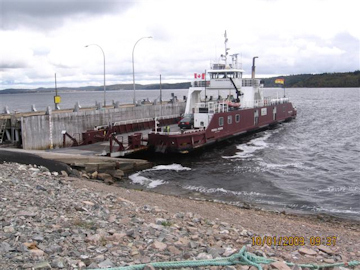
Photo by Tom Keating
October 1, 2009
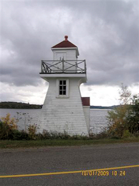
Photo by Tom Keating
October 1, 2009
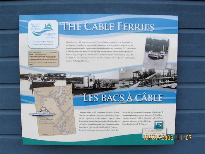
Photo by Tom Keating
October 1, 2009
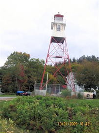
Photo by Liz Keating
October 1, 2009
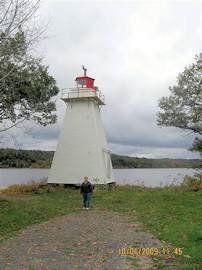
Photo by Tom Keating
October 1, 2009
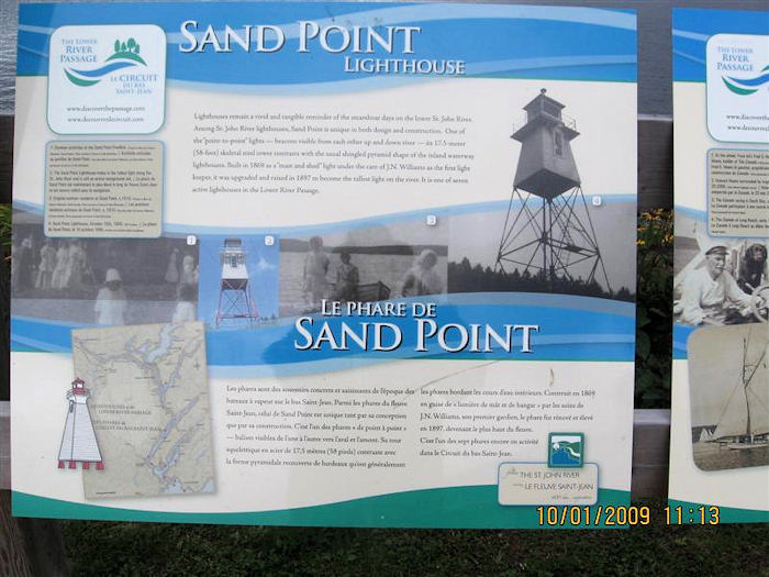
Photo by Tom Keating
October 1, 2009
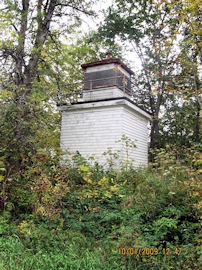
Photo by Tom Keating
October 1, 2009
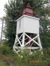
Photo by Liz Keating
October 1, 2009
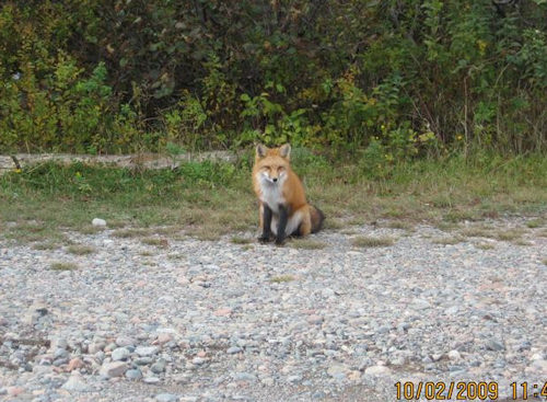
Photo by Liz Keating
October 2, 2009